Cof Cymru: National Historic Assets of Wales · Wales
Ty'n-Llwyn Farmhouse
Corwen, Denbighshire, Wales
A Grade II listed building in Carrog, Corwen, Denbighshire, designated on 1 February 1995.
The record
- Designation
- Listed building, Grade II
- Broad class
- Education
- Date of designation
- 1 February 1995
- Locality
- Carrog
- Community
- Corwen
- Unitary authority
- Denbighshire
- Country
- Wales
- Coordinates
- 52.98020, -3.32723
- Cadw reference
- 15543
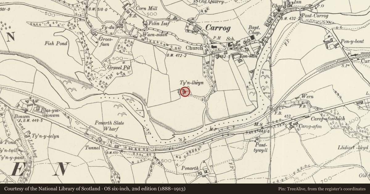
Slide toward Today to fade the historical sheet and see the modern map underneath.
David Rumsey Map Collection, Stanford LibrariesDavid Rumsey Map Collection, Stanford LibrariesLlyfrgell Genedlaethol Cymru – The National Library of WalesDavid Rumsey Map Collection, Stanford LibrariesDavid Rumsey Map Collection, Stanford Libraries
5 historical maps cover this location, the earliest the 1608 map "(13) Cambriae Typus." (David Rumsey Map Collection, Stanford Libraries).
Historical maps covering this location
- 1608 · (13) Cambriae Typus. (David Rumsey Map Collection, Stanford Libraries)
- 1795 · To Sir Watkin Williams-Wynn Bart ... the map of the six counties of North Wales is most… (Llyfrgell Genedlaethol Cymru – The National Library of Wales)
- 1883 · Watershed map England, Wales 3. (David Rumsey Map Collection, Stanford Libraries)
- 1898 · 121 Wrexham (Hills) (David Rumsey Map Collection, Stanford Libraries)
- 1901 · Sheet 9 and 10. (David Rumsey Map Collection, Stanford Libraries)
Cadw's description
Location
Down a track on the W side of the village, and close to the river.
History
The house is probably C17 in origin, but was substantially rebuilt in the 1830's, when it was used for a time as the village school. Rear wing added c1880.
Exterior
Whitewashed rubble with slate roof. 2 storeyed, 2-unit baffle entry plan, with central rear wing. Central entrance in E elevation in rustic wood porch and plank door with overlight flanked by 12-pane sash windows, that to right retaining a rough timber lintel. Upper windows are 8-pane sashes with a renewed 12-pane window over the doorway. 12-pane sash windows on each floor in S facing gable wall; casement windows in rear wing.
Interior
2-room plan in original block, with axial stack, and baffle entry. Chamfered bressumer to fireplace in N room, the other original fireplace blocked. Paired heavy spine beams in N room, with decorative bar stops to chamfer. Paired transverse beams in S room with very rough unstopped chamfers. Roof timbers said to show evidence for a raising of roof, probably as part of the early C19 renovation.
Reason for designation
A good example of an early C19 farmhouse, remodelled around an earlier core which forms the basis of the ground plan and the internal construction of the house.
Nearby in the register
- Church of St BridgetReligious, Ritual and Funeraryunder 1 mi
- Farmbuildings at Llan FarmAgriculture and Subsistenceunder 1 mi
- Llan HouseDomesticunder 1 mi
- Llan FarmhouseDomesticunder 1 mi
Other entries of the same register within about three miles of this one, by straight line.