Cof Cymru: National Historic Assets of Wales · Wales
Trewyn Fawr Farmhouse
Corwen, Denbighshire, Wales
A Grade II listed building in Corwen, Denbighshire, designated on 1 February 1995.
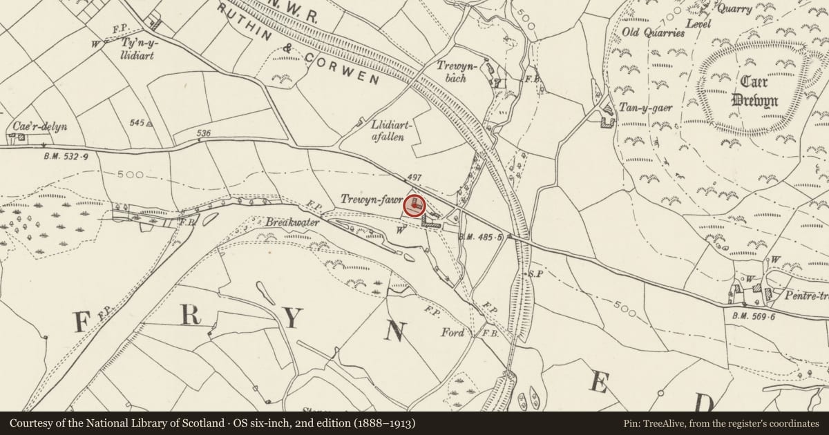
The record
- Designation
- Listed building, Grade II
- Broad class
- Domestic
- Date of designation
- 1 February 1995
- Locality
- Corwen
- Community
- Corwen
- Unitary authority
- Denbighshire
- Country
- Wales
- Coordinates
- 52.98694, -3.37107
- Cadw reference
- 15537
Slide toward Today to fade the historical sheet and see the modern map underneath.
David Rumsey Map Collection, Stanford LibrariesLlyfrgell Genedlaethol Cymru – The National Library of WalesDavid Rumsey Map Collection, Stanford LibrariesDavid Rumsey Map Collection, Stanford LibrariesDavid Rumsey Map Collection, Stanford Libraries
5 historical maps cover this location, the earliest the 1608 map "(13) Cambriae Typus." (David Rumsey Map Collection, Stanford Libraries).
Historical maps covering this location
- 1608 · (13) Cambriae Typus. (David Rumsey Map Collection, Stanford Libraries)
- 1795 · To Sir Watkin Williams-Wynn Bart ... the map of the six counties of North Wales is most… (Llyfrgell Genedlaethol Cymru – The National Library of Wales)
- 1830 · V.3:11-15:XV. Britisches Reich. A. Kon: England. b. Frstenthum Wales: Shire: 37-40 (David Rumsey Map Collection, Stanford Libraries)
- 1883 · Watershed map England, Wales 3. (David Rumsey Map Collection, Stanford Libraries)
- 1901 · Sheet 9 and 10. (David Rumsey Map Collection, Stanford Libraries)
Cadw's description
Location
Below the level of the road close to the junction with the road leading to Corwen.
Exterior
Roughly coursed tooled slate in long narrow blocks, with plinth and moulded eaves cornice, and slate roofs. Gable end and front wall stacks. 2 storeys, a long plan with rear wing to left. Central entrance flanked by 2 widely spaced windows to either side on each floor. Plank door with overlight and slate lintel; 1 ground floor window enlarged, a second renewed in original opening, but reduced in height. Upper windows are 12-pane sashes (2 renewed as pivotting small-paned windows). Brick stacks to gable end and front wall, where the chimnney projects to the right of the entrance, and has been raised in height. The right hand gable stack projects beyond the wall-line; side doorway alongside it towards the rear with blocked doorway to first floor above it (suggesting former use of first floor for storage). Small pantry or store-room projects alongside the stack towards the front of the building.
Reason for designation
An unusual example of a C18 vernacular farmhouse, distinctive for its long plan-form, and retaining much of its original character.
Nearby in the register
- Farmbuildings at Trewyn FawrAgriculture and Subsistenceunder 1 mi
- Detached Farmbuilding at Trewyn BachAgriculture and Subsistenceunder 1 mi
- Trewyn Bach B5347 (NE SIDE)Domesticunder 1 mi
- War Memorial GatesCommemorativeunder 1 mi
Other entries of the same register within about three miles of this one, by straight line.