Cof Cymru: National Historic Assets of Wales · Wales
Capel Seion
Corwen, Denbighshire, Wales
A Grade II listed building in Corwen, Denbighshire, designated on 1 February 1995.
The record
- Designation
- Listed building, Grade II
- Broad class
- Religious, Ritual and Funerary
- Date of designation
- 1 February 1995
- Locality
- Corwen
- Community
- Corwen
- Unitary authority
- Denbighshire
- Country
- Wales
- Coordinates
- 52.98108, -3.37537
- Cadw reference
- 15526
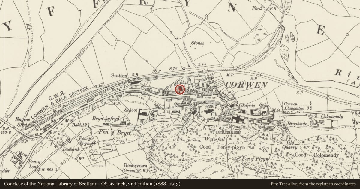
Slide toward Today to fade the historical sheet and see the modern map underneath.
David Rumsey Map Collection, Stanford LibrariesDavid Rumsey Map Collection, Stanford LibrariesLlyfrgell Genedlaethol Cymru – The National Library of WalesDavid Rumsey Map Collection, Stanford LibrariesDavid Rumsey Map Collection, Stanford Libraries
5 historical maps cover this location, the earliest the 1795 map "To Sir Watkin Williams-Wynn Bart ... the map of the six counties of North Wales is most humbly inscribed by his obedient humble servant" (Llyfrgell Genedlaethol Cymru – The National Library of Wales).
Historical maps covering this location
- 1795 · To Sir Watkin Williams-Wynn Bart ... the map of the six counties of North Wales is most… (Llyfrgell Genedlaethol Cymru – The National Library of Wales)
- 1830 · V.3:11-15:XV. Britisches Reich. A. Kon: England. b. Frstenthum Wales: Shire: 37-40 (David Rumsey Map Collection, Stanford Libraries)
- 1883 · Watershed map England, Wales 3. (David Rumsey Map Collection, Stanford Libraries)
- 1898 · 120 Corwen (Hills) (David Rumsey Map Collection, Stanford Libraries)
- 1901 · Sheet 9 and 10. (David Rumsey Map Collection, Stanford Libraries)
Cadw's description
History
A Calvinistic Methodist Chapel, established in 1800 and rebuilt in 1873. The school rooms to the rear were added in 1901.
Exterior
Roughly coursed and squared stone with freestone dressings and slate roof. Entrance in gable facing street: Shallow segmental archway with stilted hood-mould in shallow gabled porch projection. Full-height round-arched window recesses, set back in pointed arched panels to either side: flat stone lintels to lower windows, round arched heads above with impost bands. Above the entrance, a composite geometric window in round-arched recess with triple round-arched lights with continuous impost band and quatrefoil window above. Decorative quoining to angles, and ball finials to gable coping. 5-window return elevations, 2 storeyed, with round arched upper windows, and shaped stone lintels to lower openings. Windows all sashes with margin lights. School room forms a separate range at right angles to the rear, linked to the chapel by a single storeyed lobby.
Nearby in the register
- The TerreceDomesticunder 1 mi
- The TerreceDomesticunder 1 mi
- The TerreceDomesticunder 1 mi
- Gates and Railings at Capel SeionReligious, Ritual and Funeraryunder 1 mi
Other entries of the same register within about three miles of this one, by straight line.