Cof Cymru: National Historic Assets of Wales · Wales
Plas Mynach Lodge
Barmouth, Gwynedd, Wales
A Grade II listed building in Hendremynach, Barmouth, Gwynedd, designated on 31 January 1995.
The record
- Designation
- Listed building, Grade II
- Broad class
- Domestic
- Date of designation
- 31 January 1995
- Locality
- Hendremynach
- Community
- Barmouth
- Unitary authority
- Gwynedd
- Country
- Wales
- Coordinates
- 52.73027, -4.06233
- Cadw reference
- 15498
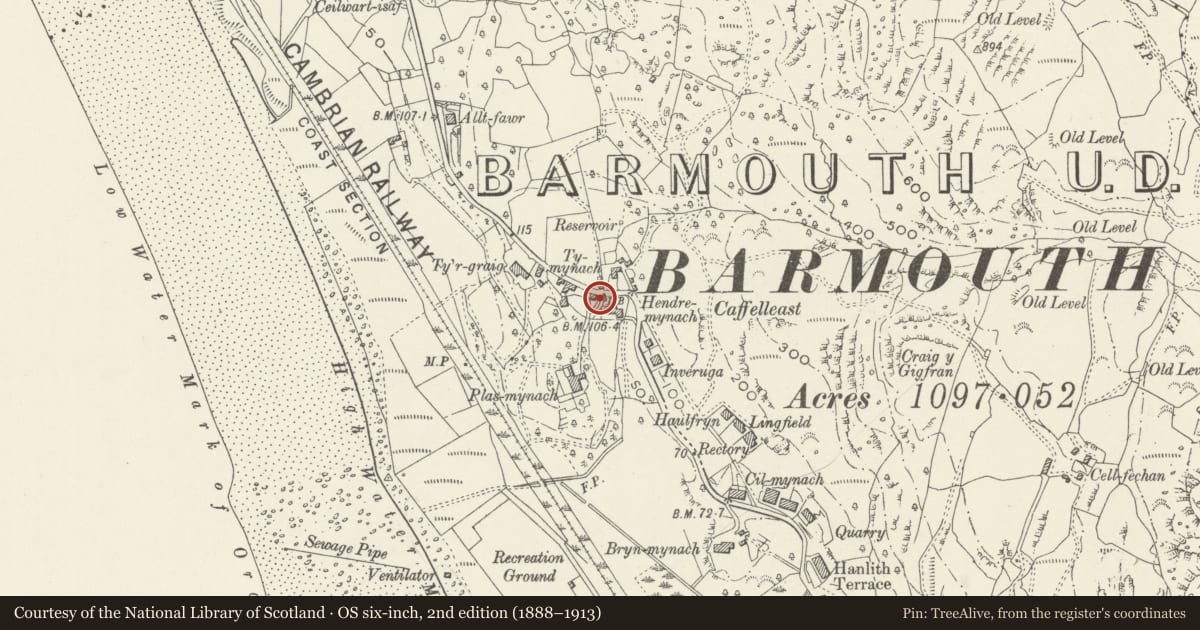
Slide toward Today to fade the historical sheet and see the modern map underneath.
David Rumsey Map Collection, Stanford LibrariesDavid Rumsey Map Collection, Stanford LibrariesDavid Rumsey Map Collection, Stanford LibrariesLlyfrgell Genedlaethol Cymru – The National Library of WalesDavid Rumsey Map Collection, Stanford Libraries
5 historical maps cover this location, the earliest the 1795 map "To Sir Watkin Williams-Wynn Bart ... the map of the six counties of North Wales is most humbly inscribed by his obedient humble servant" (Llyfrgell Genedlaethol Cymru – The National Library of Wales).
Historical maps covering this location
- 1795 · To Sir Watkin Williams-Wynn Bart ... the map of the six counties of North Wales is most… (Llyfrgell Genedlaethol Cymru – The National Library of Wales)
- 1883 · Watershed map England, Wales 3. (David Rumsey Map Collection, Stanford Libraries)
- 1896 · Sheet 7. Ordnance Survey of England and Wales. (David Rumsey Map Collection, Stanford Libraries)
- 1899 · 149 Barmouth (Hills) (David Rumsey Map Collection, Stanford Libraries)
- 1901 · Sheet 9 and 10. (David Rumsey Map Collection, Stanford Libraries)
Cadw's description
Location
Set back slightly from the main road behind a rubble wall splayed inwards to R and terminating in a dressed stone gatepier with conical capping.
History
1880s lodge to Plas Mynach, built for W H Jones to designs by John Douglas, architect of Chester.
Exterior
Single-storey plus basement; roughly rectangular in plan. Snecked rubble facings and whitened limestone dressings, with slate roof and tiled ridges; oversailing eaves anddeep verges with exposed rafter ends. Single and 2-light mullionedwindows with 8 and 16-pane glazing. Projecting, gabled porch baytowards road with entrance to W face; C20 glazed double doors. Plainrectangular central stack.
Reason for designation
Included for its special interest as part of Douglas' Plas Mynachcomplex.
Group value with Porth Mynach.
Nearby in the register
- Porth MynachDomesticunder 1 mi
- Plas MynachDomesticunder 1 mi
- Catholic Church of St Tudwal including attached presbyteryReligious, Ritual and Funeraryunder 1 mi
- Church HallRecreationalunder 1 mi
Other entries of the same register within about three miles of this one, by straight line.