Cof Cymru: National Historic Assets of Wales · Wales
Former Coach House and Stables at Glan-y-Mawddach
Barmouth, Gwynedd, Wales
A Grade II listed building in Cutiau, Barmouth, Gwynedd, designated on 31 January 1995.
The record
- Designation
- Listed building, Grade II
- Broad class
- Domestic
- Date of designation
- 31 January 1995
- Locality
- Cutiau
- Community
- Barmouth
- Unitary authority
- Gwynedd
- Country
- Wales
- Coordinates
- 52.72941, -4.03035
- Cadw reference
- 15494
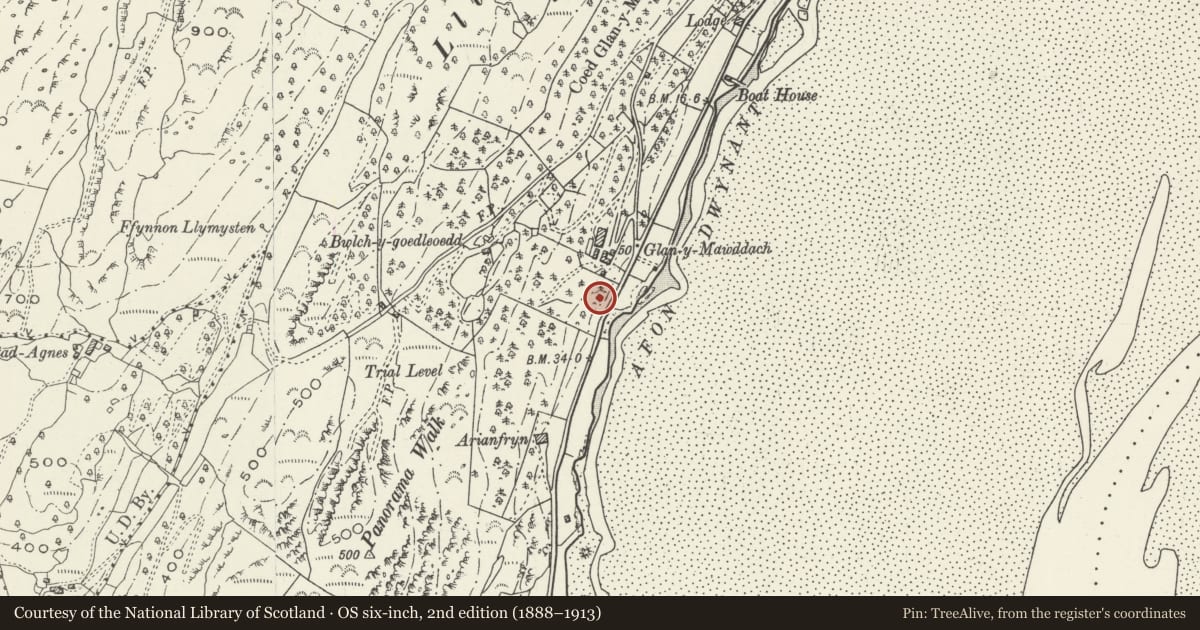
Slide toward Today to fade the historical sheet and see the modern map underneath.
David Rumsey Map Collection, Stanford LibrariesDavid Rumsey Map Collection, Stanford LibrariesDavid Rumsey Map Collection, Stanford LibrariesLlyfrgell Genedlaethol Cymru – The National Library of WalesDavid Rumsey Map Collection, Stanford Libraries
5 historical maps cover this location, the earliest the 1795 map "To Sir Watkin Williams-Wynn Bart ... the map of the six counties of North Wales is most humbly inscribed by his obedient humble servant" (Llyfrgell Genedlaethol Cymru – The National Library of Wales).
Historical maps covering this location
- 1795 · To Sir Watkin Williams-Wynn Bart ... the map of the six counties of North Wales is most… (Llyfrgell Genedlaethol Cymru – The National Library of Wales)
- 1883 · Watershed map England, Wales 3. (David Rumsey Map Collection, Stanford Libraries)
- 1896 · Sheet 7. Ordnance Survey of England and Wales. (David Rumsey Map Collection, Stanford Libraries)
- 1899 · 149 Barmouth (Hills) (David Rumsey Map Collection, Stanford Libraries)
- 1901 · Sheet 9 and 10. (David Rumsey Map Collection, Stanford Libraries)
Cadw's description
Location
Located beneath the house to the SE, and enclosing a cobbled court onthe S and W sides.
Exterior
L-shaped coach house and stable block, now a garage. Second quarterC19, remodelled at the turn of the C20 and again post war. 2 storey,rubble construction with renewed slate roofs. Large modern boardedgarage doors to S range with boarded door to R; plain 2-pane fan. Boarded and gabled loading bay above, breaking the eaves. The W rangehas a segmental-arched cart entrance to the right-hand, gabled baywith boarded double doors; above this a C19 near-flush 36-pane sashwindow. 3 further boarded doors to ground floor L, the first,formerly a further cart entrance, with adjoining 4-pane window extended across to form a triple-pane fan. The other 2 doorways are contained in a flush section to the L, slightly stepped-down. To the extreme L a 4-pane sash window; 3 further, similar windows to firstfloor.
At the entrance to the coach yard, to the N, a pair of square rubblegate piers with stepped capping; surmounting figures of heraldic griffins bearing shields with letter K (for Keighley), of re-constituted stone.
Reason for designation
Included for group value with Glan-y-Mawddach.
Nearby in the register
- Glan-y-MawddachDomesticunder 1 mi
- Adjoining raised Terrace to Eof Glan-y-MawddachDomesticunder 1 mi
- Decorative Garden Gates and Gate Piers at Glan-y-MawddachDomesticunder 1 mi
- Summerhouse at Glan-y-MawddachGardens, Parks and Urban Spacesunder 1 mi
Other entries of the same register within about three miles of this one, by straight line.