Cof Cymru: National Historic Assets of Wales · Wales
Caprera Cottage
Barmouth, Gwynedd, Wales
A Grade II listed building in Old Barmouth, Barmouth, Gwynedd, designated on 31 January 1995.
The record
- Designation
- Listed building, Grade II
- Broad class
- Domestic
- Date of designation
- 31 January 1995
- Locality
- Old Barmouth
- Community
- Barmouth
- Unitary authority
- Gwynedd
- Country
- Wales
- Coordinates
- 52.72094, -4.05138
- Cadw reference
- 15471
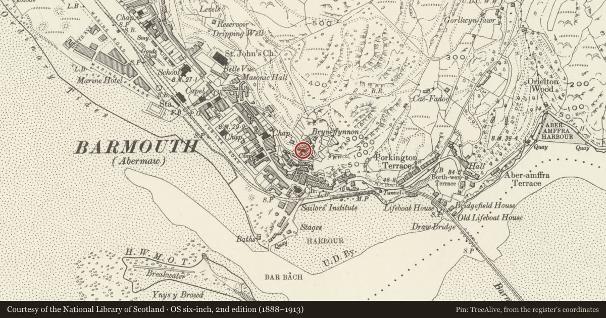
Slide toward Today to fade the historical sheet and see the modern map underneath.
David Rumsey Map Collection, Stanford LibrariesDavid Rumsey Map Collection, Stanford LibrariesDavid Rumsey Map Collection, Stanford LibrariesLlyfrgell Genedlaethol Cymru – The National Library of WalesDavid Rumsey Map Collection, Stanford Libraries
5 historical maps cover this location, the earliest the 1795 map "To Sir Watkin Williams-Wynn Bart ... the map of the six counties of North Wales is most humbly inscribed by his obedient humble servant" (Llyfrgell Genedlaethol Cymru – The National Library of Wales).
Historical maps covering this location
- 1795 · To Sir Watkin Williams-Wynn Bart ... the map of the six counties of North Wales is most… (Llyfrgell Genedlaethol Cymru – The National Library of Wales)
- 1883 · Watershed map England, Wales 3. (David Rumsey Map Collection, Stanford Libraries)
- 1896 · Sheet 7. Ordnance Survey of England and Wales. (David Rumsey Map Collection, Stanford Libraries)
- 1899 · 149 Barmouth (Hills) (David Rumsey Map Collection, Stanford Libraries)
- 1901 · Sheet 9 and 10. (David Rumsey Map Collection, Stanford Libraries)
Cadw's description
Location
Located towards the top of the old town above Bron Eifion behind a small, dwarf-walled terrace.
History
The cottage is one of the St. George's Guild Cottages and formed one of originally 13 units which formerly served a community founded by John Ruskin. From 1871 Ruskin published his socialist theories in a series of letters- the Fors Clavigera- which were addressed to `the working men of England.' In that year he founded the Guild of St. George, `a society established to carry out certain charitable acts,' and the community at Barmouth was his first social experiment. It was made possible by the donation in 1874 of the land and cottages by Mrs Talbot of Tyn-y-Fynnon, a friend of Ruskin's and a sympathiser with his beliefs. The rents for the cottages were fixed at between 35s and ú5 per year.
Exterior
A probably early C18 cottage, altered in the C19 and C20. Single storey plus attic; 2 window front. Of rubble with slate roofand rubble gable parapets with squat end chimney to L; weathercoursing. Plain modern boarded door to centre with flanking modernwindows. 2 large, high-set late C19 triangular dormers withpebble-dashed faces and modern windows as before.
Interior
Inglenook with plain ingle beam and thin, crude beams to ceiling in ground floor room to L.
Reason for designation
Included despite window alterations as one of Ruskin's guild cottages and consequently of considerable socio-historic interest as a group.
Nearby in the register
- 3 & 4 St George's TerraceDomesticunder 1 mi
- 2 St George's TerraceDomesticunder 1 mi
- 1 St George's TerraceDomesticunder 1 mi
- Pen-y-Gribin & Bwth-yn--Bryn) with rear attached outbuildg & Stone Steps adjoining to SWDomesticunder 1 mi
Other entries of the same register within about three miles of this one, by straight line.