Cof Cymru: National Historic Assets of Wales · Wales
Trederwyn Hall (also known as Trederwyn Farm)
Llandrinio, Powys, Wales
A Grade II listed building in Trederwyn, Llandrinio, Powys, designated on 29 December 1994.
The record
- Designation
- Listed building, Grade II
- Broad class
- Domestic
- Date of designation
- 29 December 1994
- Locality
- Trederwyn
- Community
- Llandrinio
- Unitary authority
- Powys
- Country
- Wales
- Coordinates
- 52.73418, -3.09344
- Cadw reference
- 15435
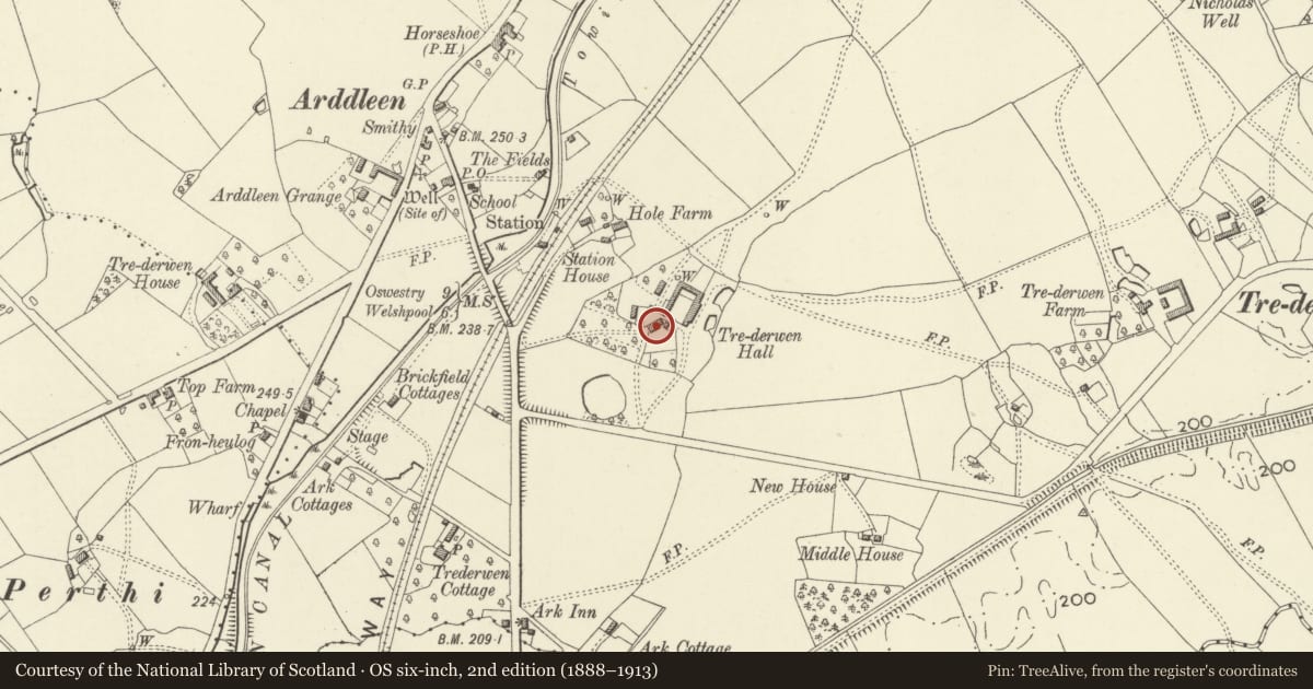
Slide toward Today to fade the historical sheet and see the modern map underneath.
David Rumsey Map Collection, Stanford LibrariesDavid Rumsey Map Collection, Stanford LibrariesDavid Rumsey Map Collection, Stanford LibrariesDavid Rumsey Map Collection, Stanford LibrariesLlyfrgell Genedlaethol Cymru – The National Library of Wales
5 historical maps cover this location, the earliest the 1795 map "To Sir Watkin Williams-Wynn Bart ... the map of the six counties of North Wales is most humbly inscribed by his obedient humble servant" (Llyfrgell Genedlaethol Cymru – The National Library of Wales).
Historical maps covering this location
- 1795 · To Sir Watkin Williams-Wynn Bart ... the map of the six counties of North Wales is most… (Llyfrgell Genedlaethol Cymru – The National Library of Wales)
- 1883 · Watershed map England, Wales 3. (David Rumsey Map Collection, Stanford Libraries)
- 1899 · 151 Welshpool (Hills) (David Rumsey Map Collection, Stanford Libraries)
- 1901 · Sheet 9 and 10. (David Rumsey Map Collection, Stanford Libraries)
- 1916 · Sheet 60. Shrewsbury. (David Rumsey Map Collection, Stanford Libraries)
Cadw's description
Location
Standing within the township of Ardd-l_n on low lying ground.
History
Farmhouse. C17 and C19. The seat of the important Vaughan family. Belonged to the Lord of the Manor until 1823 when it was sold by the Earl of Darlington to a Mr Peel.
Exterior
Timber framed, replaced by brick in C19, with machine tiled roof. Two storeys 3 bays, with fourth bay added at W end. Entrance in centre bay, probably originally forming lobby with stack, and original service room in E bay. Entrance to rear within C20 glazed lean-to structure. C20 two and three-light paned timber windows. C19 yellow brick octagonal stacks to centre and west stacks.
Interior
Main hall bay has deeply chamfered cross beams with check and scoop stops, and secondary chamfered joists placed in alternating directions. Major stack with fire lintel, marked by rushlights. Chamfered spine beams in service room and parlour behind stack. Post under spine beams in service room and parlour behind stack. Post under spine beam of original gable has simple decorated jowl, the post now reversed. Roof not seen.
Reason for designation
Large vernacular farmhouse retaining substantial character from C17 and later.
Nearby in the register
- Milestone at roadside to SE of Montgomeryshire CanalTransportunder 1 mi
- Presbyterian ChapelReligious, Ritual and Funeraryunder 1 mi
- ManseDomesticunder 1 mi
- Trederwen HouseDomesticunder 1 mi
Other entries of the same register within about three miles of this one, by straight line.