Cof Cymru: National Historic Assets of Wales · Wales
Operating Gear
Llandrinio, Powys, Wales
A Grade II listed building in Burgedin Lock, Burgedin, Llandrinio, Powys, designated on 29 December 1994.
The record
- Designation
- Listed building, Grade II
- Broad class
- Transport
- Date of designation
- 29 December 1994
- Locality
- Burgedin Lock
- Town
- Burgedin
- Community
- Llandrinio
- Unitary authority
- Powys
- Country
- Wales
- Coordinates
- 52.72514, -3.10780
- Cadw reference
- 15419
Slide toward Today to fade the historical sheet and see the modern map underneath.
David Rumsey Map Collection, Stanford LibrariesDavid Rumsey Map Collection, Stanford LibrariesDavid Rumsey Map Collection, Stanford LibrariesDavid Rumsey Map Collection, Stanford LibrariesLlyfrgell Genedlaethol Cymru – The National Library of Wales
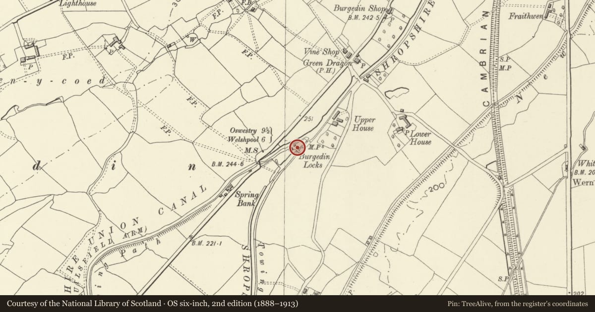
5 historical maps cover this location, the earliest the 1795 map "To Sir Watkin Williams-Wynn Bart ... the map of the six counties of North Wales is most humbly inscribed by his obedient humble servant" (Llyfrgell Genedlaethol Cymru – The National Library of Wales).
Historical maps covering this location
- 1795 · To Sir Watkin Williams-Wynn Bart ... the map of the six counties of North Wales is most… (Llyfrgell Genedlaethol Cymru – The National Library of Wales)
- 1883 · Watershed map England, Wales 3. (David Rumsey Map Collection, Stanford Libraries)
- 1899 · 151 Welshpool (Hills) (David Rumsey Map Collection, Stanford Libraries)
- 1901 · Sheet 9 and 10. (David Rumsey Map Collection, Stanford Libraries)
- 1916 · Sheet 60. Shrewsbury. (David Rumsey Map Collection, Stanford Libraries)
Cadw's description
History
Lock chamber below the main pound. Before 1797, renovated c.1880.
Exterior
Engineering brick walls with heavy gritstone coping. Upper end has ground paddle and radial arm gear by Coalbrookdale Co. surrounded on 3 sides by heavy stone blocks. Paddle gear probably designed by George Buck during engineering improvements (1819-31). Iron shod timber gates removed at time of inspection, August 1994. Narrowing of main pound walls also of blue brick.
On N side, a feeder stream with tapered spillway, having a central flume controlled by a ratchet paddle gear, and C20 60m spun concrete culvert to a blue brick interceptor bay at the side of the tapering walls of the main pound.
Reason for designation
One number of original canal structures at Burgedin on the Montgomeryshire Canal forming a group of special interest.
Nearby in the register
- Canal outbuildings to E of Lengthsman's House at Burgedin LocksDomesticunder 1 mi
- Outbuilding to E of Lengthsman's House at Burgedin LockDomesticunder 1 mi
- Upper Lock ChamberTransportunder 1 mi
- Lengthsman's House at Burgedin LockDomesticunder 1 mi
Other entries of the same register within about three miles of this one, by straight line.