Cof Cymru: National Historic Assets of Wales · Wales
Kitchen Garden Walls
Llandrinio, Powys, Wales
A Grade II listed building in Llandrinio, Powys, designated on 29 December 1994.
The record
- Designation
- Listed building, Grade II
- Broad class
- Domestic
- Date of designation
- 29 December 1994
- Locality
- Llandrinio
- Community
- Llandrinio
- Unitary authority
- Powys
- Country
- Wales
- Coordinates
- 52.74894, -3.05345
- Cadw reference
- 15404
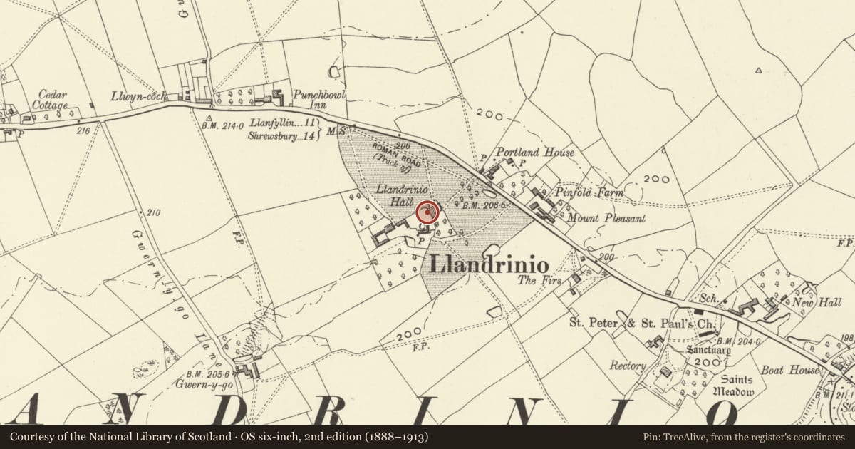
Slide toward Today to fade the historical sheet and see the modern map underneath.
David Rumsey Map Collection, Stanford LibrariesDavid Rumsey Map Collection, Stanford LibrariesDavid Rumsey Map Collection, Stanford LibrariesDavid Rumsey Map Collection, Stanford LibrariesLlyfrgell Genedlaethol Cymru – The National Library of Wales
5 historical maps cover this location, the earliest the 1795 map "To Sir Watkin Williams-Wynn Bart ... the map of the six counties of North Wales is most humbly inscribed by his obedient humble servant" (Llyfrgell Genedlaethol Cymru – The National Library of Wales).
Historical maps covering this location
- 1795 · To Sir Watkin Williams-Wynn Bart ... the map of the six counties of North Wales is most… (Llyfrgell Genedlaethol Cymru – The National Library of Wales)
- 1883 · Watershed map England, Wales 3. (David Rumsey Map Collection, Stanford Libraries)
- 1897 · 137 Oswestry (Hills) (David Rumsey Map Collection, Stanford Libraries)
- 1901 · Sheet 9 and 10. (David Rumsey Map Collection, Stanford Libraries)
- 1916 · Sheet 60. Shrewsbury. (David Rumsey Map Collection, Stanford Libraries)
Cadw's description
Location
A group of farm buildings and walls immediately SW of Llandrinio Hall standing well back from the road.
History
Former Kitchen garden to Llandrinio Hall, with farm building, possibly the original carriage house. c.1680
Exterior
Walls: Forming a large irregular enclosure with the building at the NW corner facing the original access drive to the house. The north side and most of the E side survives to the original height of approximately 3m, but some sections rebuilt above 2m.
The NW building: Converted to cattle stabling and loose boxes in C19, with all openings altered including 2 wide openings on N side. Five bay double purlins with central strut to collar, all with carpenter's marks. The early brick work returns on the E side forming the W wall of a barn attached at right angles to its S face.
Piggery: On the S side, apparently built against the north side of the wall, a piggery with attic, formerly a malting house inscribed in paint 'WR 1789 Malster'.
At the E side of the enclosure a C 19 brick range of 5 pig-sties with larger boar house at the S end, each style 3m x 2.4 with 3.2 wide run.
Reason for designation
Included as an interesting group of farm buildings within a walled enclosure of group importance with Llandrinio Hall.
Nearby in the register
- Llandrinio HallDomesticunder 1 mi
- Outbuildings, formerly of Llandrinio HallDomesticunder 1 mi
- Outbuilding, formerly of Llandrinio HallDomesticunder 1 mi
- Milemarker at roadside about 200m NW of Llandrinio HallTransportunder 1 mi
Other entries of the same register within about three miles of this one, by straight line.