Cof Cymru: National Historic Assets of Wales · Wales
Wernddofn
Boncath, Pembrokeshire, Wales
A Grade II listed building in Wernddofn, Boncath, Pembrokeshire, designated on 25 January 1995.
The record
- Designation
- Listed building, Grade II
- Broad class
- Domestic
- Date of designation
- 25 January 1995
- Locality
- Wernddofn
- Community
- Boncath
- Unitary authority
- Pembrokeshire
- Country
- Wales
- Coordinates
- 52.00100, -4.60641
- Cadw reference
- 15399
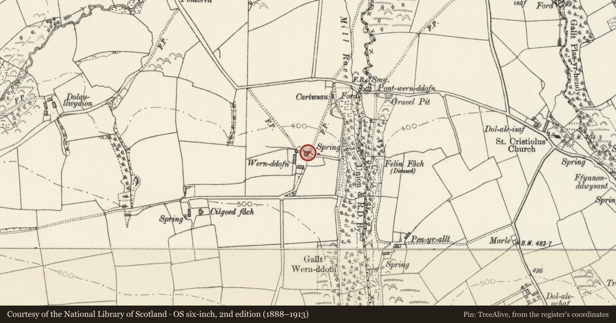
Slide toward Today to fade the historical sheet and see the modern map underneath.
David Rumsey Map Collection, Stanford LibrariesDavid Rumsey Map Collection, Stanford LibrariesDavid Rumsey Map Collection, Stanford LibrariesDavid Rumsey Map Collection, Stanford LibrariesDavid Rumsey Map Collection, Stanford Libraries
5 historical maps cover this location, the earliest the 1608 map "(13) Cambriae Typus." (David Rumsey Map Collection, Stanford Libraries).
Historical maps covering this location
- 1608 · (13) Cambriae Typus. (David Rumsey Map Collection, Stanford Libraries)
- 1636 · Cornubia : Devonia, Somersetus, Dorcestria, Wiltonia, Glocestria ... (David Rumsey Map Collection, Stanford Libraries)
- 1637 · Particular description of Wales. Cambria seu Wallia (David Rumsey Map Collection, Stanford Libraries)
- 1830 · V.3:11-15:XV. Britisches Reich. A. Kon: England. b. Frstenthum Wales: Shire: 37-40 (David Rumsey Map Collection, Stanford Libraries)
- 1891 · Sheet 10. Ordnance Survey of England and Wales. . (David Rumsey Map Collection, Stanford Libraries)
Cadw's description
Location
Situated about 1km W of Penrydd church, W of Dulas stream.
History
Early C19 gentry house, the history obscure before 1837 when it was sold as part of the estate of the late Col. Morgan of Brynaeron, Llandissilio. 1837 plan shows house and one outbuilding to N, described as newly built. The house is called a mansion house and had 374 acres. Marked on 1840 Tithe Map as owned by John Colby of Ffynone, William Evans was tenant of both owners.
Exterior
Early C19 small country house, whitewashed stucco with slate roofs and rendered end stacks. Two storeys and attic, three-window front with moulded stone eaves course and bedimental gable. Pediment has lunette recess with inset 9-pane window. Main floors have unusual use of the tripartite Venetian window for all five windows. 4-12-4-pane with intersecting glazing bars in centre arched heads. Centre ledged door with traceried radiating bar fanlight. Two parallel rear wings with end stacks. E side of E wing has 8-pane sash each floor and door to right, the sashes horned probably replacing 16-pane sashes. W side of W wing has 4-pane window over 8-pane to right and 8-pane stair light over 4-pane to left.
Reason for designation
Listed as a small country house most unusual in having five Venetian windows to facade.
Nearby in the register
- Felinwen MillIndustrialunder 1 mi
- RhydhowellDomesticunder 1 mi
- Maen ColmanCross-marked stoneunder 1 mi
- Outbuilding Range SW of Farmhouse at Kings FarmAgriculture and Subsistenceunder 1 mi
Other entries of the same register within about three miles of this one, by straight line.