Cof Cymru: National Historic Assets of Wales · Wales
Lofted Cartshed at Cilwendeg Farm
Boncath, Pembrokeshire, Wales
A Grade II listed building in Capel Colman, Boncath, Pembrokeshire, designated on 25 January 1995.
The record
- Designation
- Listed building, Grade II
- Broad class
- Agriculture and Subsistence
- Date of designation
- 25 January 1995
- Locality
- Capel Colman
- Community
- Boncath
- Unitary authority
- Pembrokeshire
- Country
- Wales
- Coordinates
- 52.01885, -4.59300
- Cadw reference
- 15397
Slide toward Today to fade the historical sheet and see the modern map underneath.
David Rumsey Map Collection, Stanford LibrariesDavid Rumsey Map Collection, Stanford LibrariesDavid Rumsey Map Collection, Stanford LibrariesDavid Rumsey Map Collection, Stanford LibrariesDavid Rumsey Map Collection, Stanford Libraries
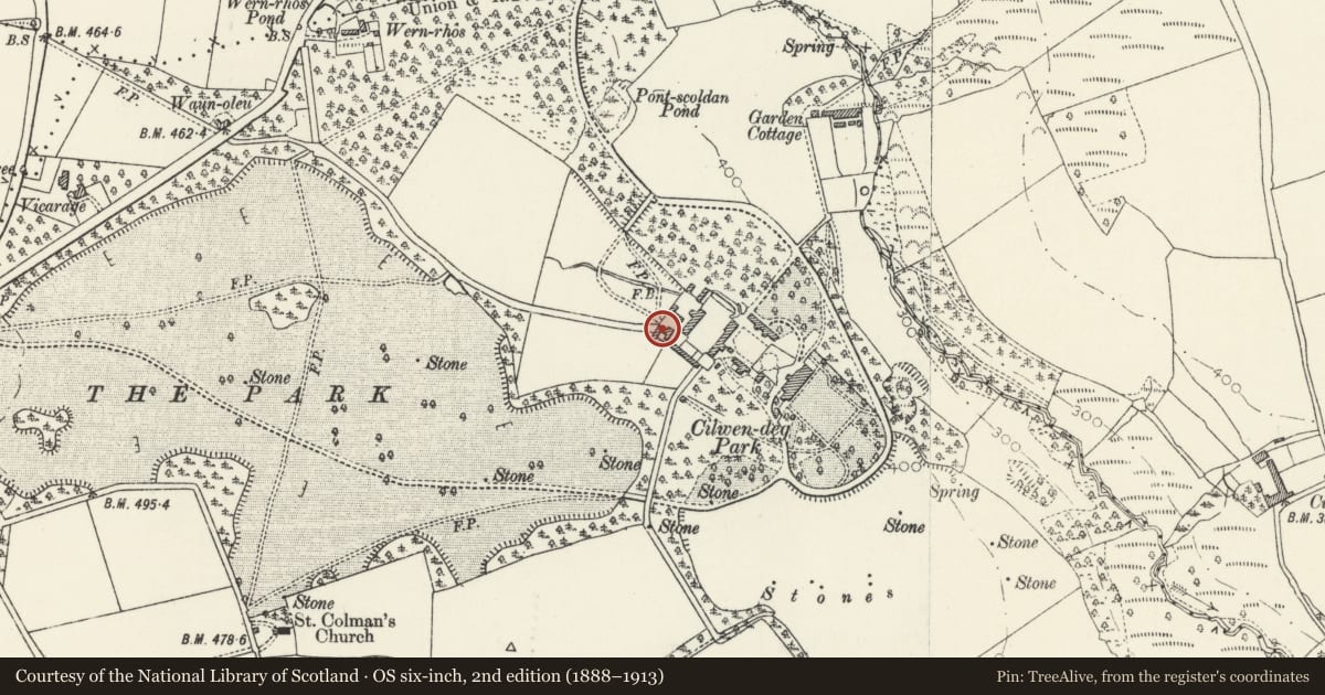
5 historical maps cover this location, the earliest the 1608 map "(13) Cambriae Typus." (David Rumsey Map Collection, Stanford Libraries).
Historical maps covering this location
- 1608 · (13) Cambriae Typus. (David Rumsey Map Collection, Stanford Libraries)
- 1636 · Cornubia : Devonia, Somersetus, Dorcestria, Wiltonia, Glocestria ... (David Rumsey Map Collection, Stanford Libraries)
- 1830 · V.3:11-15:XV. Britisches Reich. A. Kon: England. b. Frstenthum Wales: Shire: 37-40 (David Rumsey Map Collection, Stanford Libraries)
- 1891 · Sheet 10. Ordnance Survey of England and Wales. . (David Rumsey Map Collection, Stanford Libraries)
- 1898 · 211 Newcastle Emlyn (Hills) (David Rumsey Map Collection, Stanford Libraries)
Cadw's description
Location
Situated at W corner of farmyard at Cilwendeg Farm, facing SE.
History
Probably built in the 1830s as part of the extensive improvements carried out by Morgan Jones 2 d 1840.
Exterior
Earlier C19 lofted cartshed, rubble stone with slate roof. Long range with two small 2-light loft windows with slate sills, shutters and timber lintels, symmetrically over four tall elliptical arched cart-entries with square piers and Cilgerran stone voussoirs. N end wall has loft-window with cut stone voussoirs. S gable has (1994) partially collapsed. Pine floor beams and stapled collar trusses pegged at apex. Rear attached small court of single storey outbuildings on three sides, that to E with corrugated sheet roof and three broad windows, one with door. Rear broad door flanked by loops. N range has graded slate roof, hipped to E, two cut-stone arches to right, one open, one part-blocked and two full-height openings to left with concrete block pier between. Short W return has graded slates, two cut-stone arches and end gable loft light over door.
Nearby in the register
- Barn & Stable Range at Cilwendeg FarmDomesticunder 1 mi
- Open Bay Cow House at Cilwendeg FarmAgriculture and Subsistenceunder 1 mi
- The Pigeon House and railings at Cilwendeg FarmAgriculture and Subsistenceunder 1 mi
- The Counting House at Cilwendeg FarmDomesticunder 1 mi
Other entries of the same register within about three miles of this one, by straight line.