Cof Cymru: National Historic Assets of Wales · Wales
Bryn Hir Arms including Archway to yard
Criccieth, Gwynedd, Wales
A Grade II listed building in Criccieth, Gwynedd, designated on 12 December 1994.
The record
- Designation
- Listed building, Grade II
- Broad class
- Commercial
- Date of designation
- 12 December 1994
- Community
- Criccieth
- Unitary authority
- Gwynedd
- Country
- Wales
- Coordinates
- 52.91934, -4.23490
- Cadw reference
- 15373
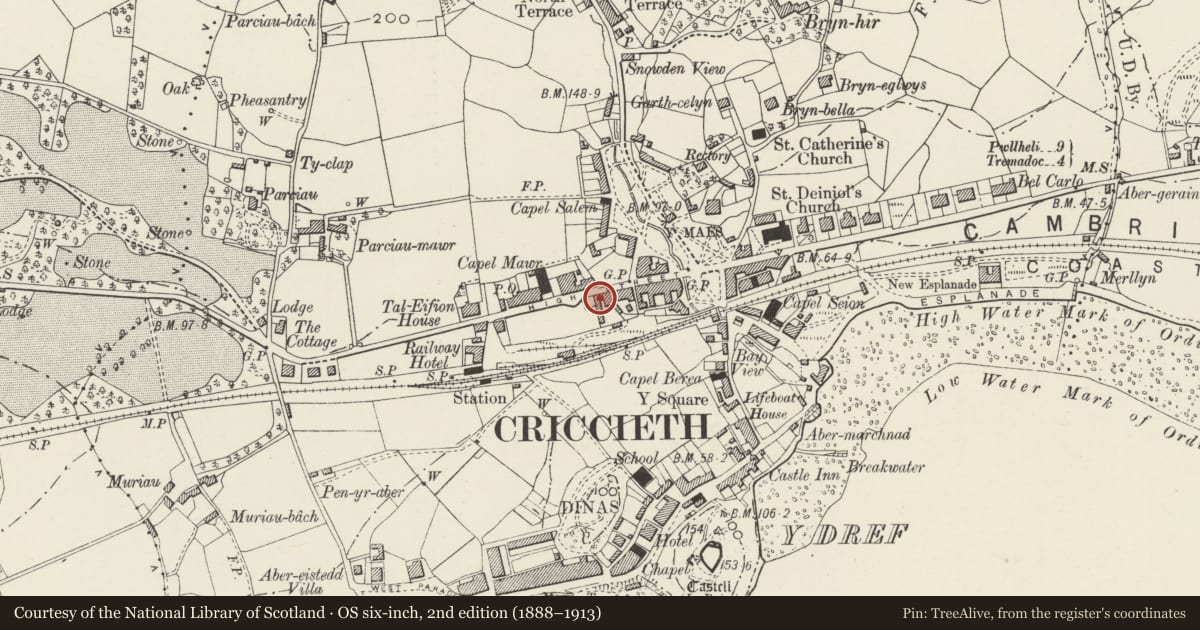
Slide toward Today to fade the historical sheet and see the modern map underneath.
David Rumsey Map Collection, Stanford LibrariesDavid Rumsey Map Collection, Stanford LibrariesDavid Rumsey Map Collection, Stanford LibrariesLlyfrgell Genedlaethol Cymru – The National Library of WalesDavid Rumsey Map Collection, Stanford Libraries
5 historical maps cover this location, the earliest the 1795 map "To Sir Watkin Williams-Wynn Bart ... the map of the six counties of North Wales is most humbly inscribed by his obedient humble servant" (Llyfrgell Genedlaethol Cymru – The National Library of Wales).
Historical maps covering this location
- 1795 · To Sir Watkin Williams-Wynn Bart ... the map of the six counties of North Wales is most… (Llyfrgell Genedlaethol Cymru – The National Library of Wales)
- 1883 · Watershed map England, Wales 3. (David Rumsey Map Collection, Stanford Libraries)
- 1896 · Sheet 7. Ordnance Survey of England and Wales. (David Rumsey Map Collection, Stanford Libraries)
- 1899 · 118 Nevin (Hills) (David Rumsey Map Collection, Stanford Libraries)
- 1901 · Sheet 9 and 10. (David Rumsey Map Collection, Stanford Libraries)
Cadw's description
Location
At the W end of the continuously developed building line, almost opposite the George IV Hotel.
History
Small public house, probably purpose-built as an inn associated with the new turnpike road, in c1840 (the building post-dates the Tithe Map, which does however record an inn of the same name closer to the Castle).
Exterior
Heavy roughly squared stone, and slate roof with roughcast rendered end wall stacks. 2 storeys, 3-window range with central entrance leading to small lobby. 12-pane sash windows flanking the entrance and to first floor, all with flat stone lintels. Plain overhanging eaves. At the E side of the building a carriage entry with segmental voussoir arch leads to the rear yard. Interior retains original layout with small lobby entrance leading to principal bars to either side, but little original details survives.
Reason for designation
A well-preserved small public house of the early C19.
Nearby in the register
- National Westminster BankCommercialunder 1 mi
- George IV HotelCommercialunder 1 mi
- Capel MawrReligious, Ritual and Funeraryunder 1 mi
- Cafe CwrtDomesticunder 1 mi
Other entries of the same register within about three miles of this one, by straight line.