Cof Cymru: National Historic Assets of Wales · Wales
Summerhouse in grounds of Rookwood
Clyro, Powys, Wales
A Grade II listed building in Bronydd, Clyro, Powys, designated on 31 January 1995.
The record
- Designation
- Listed building, Grade II
- Broad class
- Gardens, Parks and Urban Spaces
- Date of designation
- 31 January 1995
- Locality
- Bronydd
- Community
- Clyro
- Unitary authority
- Powys
- Country
- Wales
- Coordinates
- 52.09964, -3.12835
- Cadw reference
- 15324
Slide toward Today to fade the historical sheet and see the modern map underneath.
David Rumsey Map Collection, Stanford LibrariesDavid Rumsey Map Collection, Stanford LibrariesDavid Rumsey Map Collection, Stanford LibrariesDavid Rumsey Map Collection, Stanford LibrariesDavid Rumsey Map Collection, Stanford Libraries
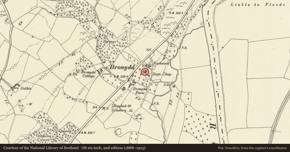
5 historical maps cover this location, the earliest the 1608 map "(13) Cambriae Typus." (David Rumsey Map Collection, Stanford Libraries).
Historical maps covering this location
- 1608 · (13) Cambriae Typus. (David Rumsey Map Collection, Stanford Libraries)
- 1636 · Cornubia : Devonia, Somersetus, Dorcestria, Wiltonia, Glocestria ... (David Rumsey Map Collection, Stanford Libraries)
- 1637 · Particular description of Wales. Cambria seu Wallia (David Rumsey Map Collection, Stanford Libraries)
- 1898 · 197 Hay (Hills) (David Rumsey Map Collection, Stanford Libraries)
- 1901 · Sheet 14. (David Rumsey Map Collection, Stanford Libraries)
Cadw's description
Location
Lies 100 metres south-west of Rookwood, and close to the Bronydd Baptist Chapel.
Exterior
C17 former dwelling. Single storey, probably truncated in size. Square-panel timber framing (with some replacement timbers and two later doorways under Tudor-arched heads), west wall rubble stone incorporating stack, stone tile roof. Four-light ovolo moulded mullion window.
Interior
Single room with exposed beams and joists, stone flag floor, large open fireplace with chamfered timber lintel. Original doorway on north side with chamfered frame now blocked.
Reason for designation
Included for group value with Rookwood.
Nearby in the register
- Bronydd Baptist ChapelReligious, Ritual and Funeraryunder 1 mi
- Attached chapel cottage (also known as Rookwood Cottage)Domesticunder 1 mi
- Courtyard Outbuildings to rear of RookwoodDomesticunder 1 mi
- RookwoodDomesticunder 1 mi
Other entries of the same register within about three miles of this one, by straight line.