Cof Cymru: National Historic Assets of Wales · Wales
Stock House
Clyro, Powys, Wales
A Grade II listed building in Clyro, Powys, designated on 31 January 1995.
The record
- Designation
- Listed building, Grade II
- Broad class
- Domestic
- Date of designation
- 31 January 1995
- Locality
- Clyro
- Community
- Clyro
- Unitary authority
- Powys
- Country
- Wales
- Coordinates
- 52.08650, -3.14961
- Cadw reference
- 15307
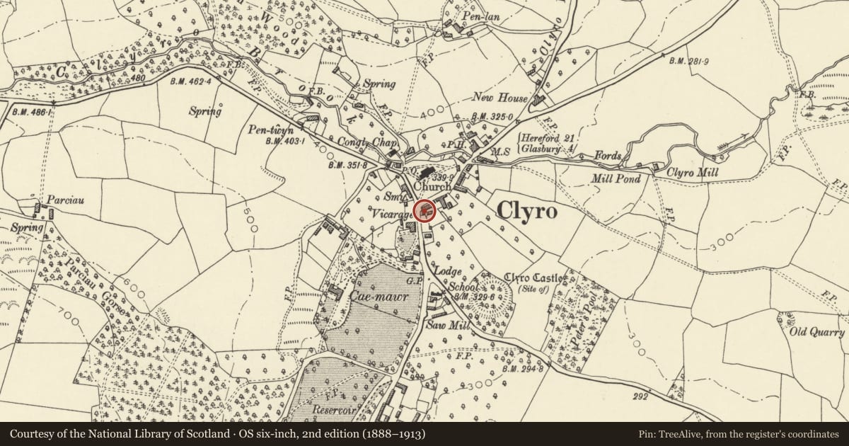
Slide toward Today to fade the historical sheet and see the modern map underneath.
David Rumsey Map Collection, Stanford LibrariesDavid Rumsey Map Collection, Stanford LibrariesDavid Rumsey Map Collection, Stanford LibrariesDavid Rumsey Map Collection, Stanford LibrariesDavid Rumsey Map Collection, Stanford Libraries
5 historical maps cover this location, the earliest the 1608 map "(13) Cambriae Typus." (David Rumsey Map Collection, Stanford Libraries).
Historical maps covering this location
- 1608 · (13) Cambriae Typus. (David Rumsey Map Collection, Stanford Libraries)
- 1636 · Cornubia : Devonia, Somersetus, Dorcestria, Wiltonia, Glocestria ... (David Rumsey Map Collection, Stanford Libraries)
- 1637 · Particular description of Wales. Cambria seu Wallia (David Rumsey Map Collection, Stanford Libraries)
- 1898 · 197 Hay (Hills) (David Rumsey Map Collection, Stanford Libraries)
- 1901 · Sheet 14. (David Rumsey Map Collection, Stanford Libraries)
Cadw's description
Location
At the south-west end of the village at right angles to Nos 4, 5 and 6 and with gable end facing the churchyard.
Exterior
Mid to late C19. Rubble, 2-storey, 3-window front with slate roof and stock brick chimney stacks. Horned 4-pane sash windows with red brick voussoirs. Central round-arched doorway with 4-panelled door with plain fanlight. The rendered red brick left hand end is stepped down and has 4-panel door to front; to the gable end, facing the churchyard is a splayed bay window with horned small-pane sash glazing and hipped roof. Two gabled dormers to rear.
Reason for designation
Included for group value with Nos 4, 5 and 6 and The Old Vicarage.
Nearby in the register
- Nos 4, 5 & 6 The VillageDomesticunder 1 mi
- Old VicarageDomesticunder 1 mi
- 20 The VillageDomesticunder 1 mi
- 21 The VillageDomesticunder 1 mi
Other entries of the same register within about three miles of this one, by straight line.