Cof Cymru: National Historic Assets of Wales · Wales
Saw Mill
Blaenavon, Torfaen, Wales
A Grade II listed building in Big Pit Mining Museum, Blaenavon, Torfaen, designated on 9 February 1995.
The record
- Designation
- Listed building, Grade II
- Broad class
- Industrial
- Date of designation
- 9 February 1995
- Locality
- Big Pit Mining Museum
- Community
- Blaenavon
- Unitary authority
- Torfaen
- Country
- Wales
- Coordinates
- 51.77188, -3.10390
- Cadw reference
- 15283
Slide toward Today to fade the historical sheet and see the modern map underneath.
David Rumsey Map Collection, Stanford LibrariesDavid Rumsey Map Collection, Stanford LibrariesDavid Rumsey Map Collection, Stanford LibrariesDavid Rumsey Map Collection, Stanford LibrariesDavid Rumsey Map Collection, Stanford Libraries
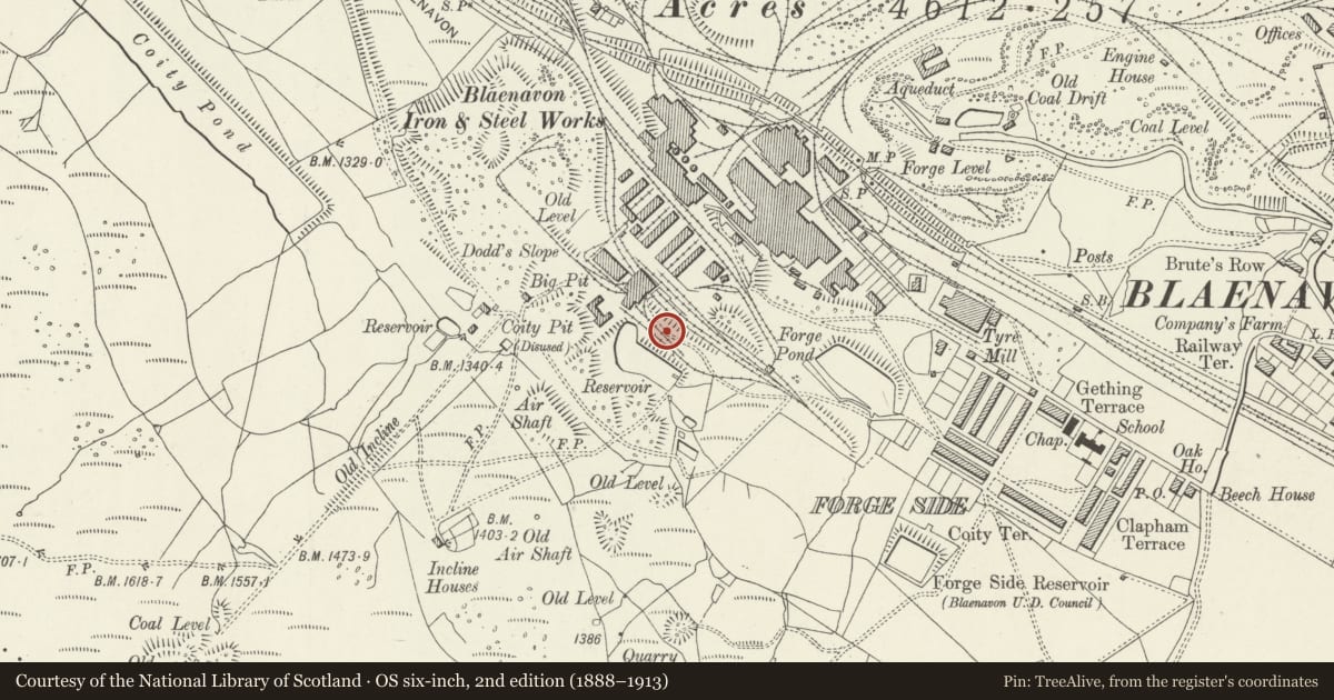
5 historical maps cover this location, the earliest the 1636 map "Cornubia : Devonia, Somersetus, Dorcestria, Wiltonia, Glocestria ..." (David Rumsey Map Collection, Stanford Libraries).
Historical maps covering this location
- 1636 · Cornubia : Devonia, Somersetus, Dorcestria, Wiltonia, Glocestria ... (David Rumsey Map Collection, Stanford Libraries)
- 1856 · 42. Brecon. (David Rumsey Map Collection, Stanford Libraries)
- 1898 · 232 Abergavenny (Hills) (David Rumsey Map Collection, Stanford Libraries)
- 1898 · 232 Abergavenny (Outline) (David Rumsey Map Collection, Stanford Libraries)
- 1913 · Sheet 102. Newport. (David Rumsey Map Collection, Stanford Libraries)
Cadw's description
Location
Situated at the east edge of the site.
History
Built before 1920, this produced timber for mine use, particularly for pit props, supporting the roof of the coal face and underground roadways. Big Pit was operated in connection with Blaenavon Ironworks, then by the National Coal Board from 1947 to 1980. Underground workings date from the early C19 but the shaft on this site was sunk in 1860. The present surface structures date from between c1900 and the 1970's. This piecemeal development was typical of mines in South Wales and it is now the most complete remaining, having been reopened as a museum in 1983.
Exterior
Single storey, rectangular, brick shed with four bays. Modern shed adjoins to south west. North-west gable has a tramway entrance with rails in place and small-pane window with segmental arch. Further, blocked entrances in north-east wall. Stepped brick cornice. Pitched roof has corrugated iron covering.
Interior
The roof structure has iron trusses. In the centre is a saw bench with circular saw.
Reason for designation
Included for group value with other listed items at this exceptionally complete colliery site.
Nearby in the register
- Pit Head Building, Headframe and Tram CircuitIndustrialunder 1 mi
- Winding Engine HouseDomesticunder 1 mi
- Deputies LodgeCommercialunder 1 mi
- Haulage Engine and Pitman's CabinDomesticunder 1 mi
Other entries of the same register within about three miles of this one, by straight line.