Cof Cymru: National Historic Assets of Wales · Wales
Hen-dy
Gwernymynydd, Flintshire, Wales
A Grade II listed building in Wendy, Gwernymynydd, Flintshire, designated on 12 December 1994.
The record
- Designation
- Listed building, Grade II
- Broad class
- Domestic
- Date of designation
- 12 December 1994
- Locality
- Wendy
- Community
- Gwernymynydd
- Unitary authority
- Flintshire
- Country
- Wales
- Coordinates
- 53.16582, -3.16679
- Cadw reference
- 15261
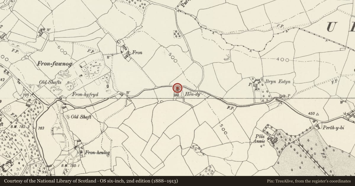
Slide toward Today to fade the historical sheet and see the modern map underneath.
David Rumsey Map Collection, Stanford LibrariesDavid Rumsey Map Collection, Stanford LibrariesDavid Rumsey Map Collection, Stanford LibrariesDavid Rumsey Map Collection, Stanford LibrariesLlyfrgell Genedlaethol Cymru – The National Library of Wales
5 historical maps cover this location, the earliest the 1795 map "To Sir Watkin Williams-Wynn Bart ... the map of the six counties of North Wales is most humbly inscribed by his obedient humble servant" (Llyfrgell Genedlaethol Cymru – The National Library of Wales).
Historical maps covering this location
- 1795 · To Sir Watkin Williams-Wynn Bart ... the map of the six counties of North Wales is most… (Llyfrgell Genedlaethol Cymru – The National Library of Wales)
- 1883 · Watershed map England, Wales 3. (David Rumsey Map Collection, Stanford Libraries)
- 1898 · 108 Flint (Hills) (David Rumsey Map Collection, Stanford Libraries)
- 1898 · 108 Flint (Outline) (David Rumsey Map Collection, Stanford Libraries)
- 1901 · Sheet 9 and 10. (David Rumsey Map Collection, Stanford Libraries)
Cadw's description
Location
At right angles to the lane, to the S, and set behind a low rubble garden wall.
Exterior
A second quarter C19 2-storeyed house under a shallow-pitched slate roof with decorative ridge-tiles and slightly oversailing eaves. Of rubble with tooled sandstone dressings. Plain brick stacks at the gable ends, each with 4 ceramic pots. 3-bay symmetrical facade with central, slightly advanced bay with shallow gable. Plain bargeboards and decorative ridge-tiles. Slightly recessed entrance with contemporary 4-panel door, the upper 2 now glazed and with a plain rectangular fan. Near-flush 12- pane window above. Similar 16-pane casements flanking on both floors. Projecting cill-course to first floor and plain stone lintels to all windows and entrance. Scribed, rendered sides and rear. The latter has mostly modern windows and has a lean-to addition to the left.
Reason for designation
Included as an interesting and unusual late Georgian house with unaltered facade.
Nearby in the register
- Plas HafodDomesticunder 1 mi
- Alleluia MonumentCommemorativeunder 1 mi
- Monument at RhaulCommemorativeunder 1 mi
- Sundial at RhualGardens, Parks and Urban Spacesunder 1 mi
Other entries of the same register within about three miles of this one, by straight line.