Cof Cymru: National Historic Assets of Wales · Wales
Tre-Llewelyn
Scleddau, Pembrokeshire, Wales
A Grade II listed building in Manorowen, Scleddau, Pembrokeshire, designated on 10 February 1995.
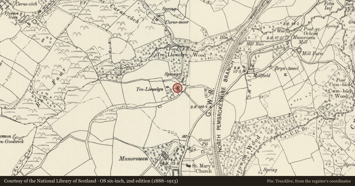
The record
- Designation
- Listed building, Grade II
- Broad class
- Domestic
- Date of designation
- 10 February 1995
- Locality
- Manorowen
- Community
- Scleddau
- Unitary authority
- Pembrokeshire
- Country
- Wales
- Coordinates
- 51.99027, -5.01058
- Cadw reference
- 15206
Slide toward Today to fade the historical sheet and see the modern map underneath.
David Rumsey Map Collection, Stanford LibrariesDavid Rumsey Map Collection, Stanford LibrariesDavid Rumsey Map Collection, Stanford LibrariesDavid Rumsey Map Collection, Stanford LibrariesDavid Rumsey Map Collection, Stanford Libraries
5 historical maps cover this location, the earliest the 1608 map "(13) Cambriae Typus." (David Rumsey Map Collection, Stanford Libraries).
Historical maps covering this location
- 1608 · (13) Cambriae Typus. (David Rumsey Map Collection, Stanford Libraries)
- 1891 · Sheet 10. Ordnance Survey of England and Wales. . (David Rumsey Map Collection, Stanford Libraries)
- 1898 · 210 Cardigan (Hills) (David Rumsey Map Collection, Stanford Libraries)
- 1898 · 210 Cardigan (Outline) (David Rumsey Map Collection, Stanford Libraries)
- 1901 · Sheet 13. (David Rumsey Map Collection, Stanford Libraries)
Cadw's description
Location
Situated to NW of A487 approximately 1km SW of Goodwick.
History
Later C17/early C18 house remodelled in early C19. Marked on the 1837 Tithe map and listed in the schedule as an 'old house' owned by the Manorowen estate. Mentioned by Fenton as Trelewhelin and as having been occupied by an unpleasant character called Thomas Philips, High Sherriff for Pembroke in 1667 and 'as noted for his avarice as his usury'.
Exterior
Later C17/early C18 house, L plan with added lean-to at rear. Rubble stone colour washed in SE front and white washed to NE end. Grouted slate roofs. Two small end wall stacks, and massive stack on end of rear wing. Front has three 16 pane sash windows on first floor and one to right on ground floor. Later 6 pane window to left and boarded door centre left. NE end has one 4 pane window on first floor and ventilated opening on end of lean-to. Rear has two 6 pane windows on lean-to and one single light facing NW on rear wing. One 2 pane window on first floor of SW end.
Interior
Interior not fully inspected but has massive beams (some boarded in) with rough cut joists.
Reason for designation
A gentry house of the later C17/early C18, remodelled in early C19 but little altered since.
Nearby in the register
- Gazebo in walled garden at ManorowenDomesticunder 1 mi
- Walled Garden at ManorowenDomesticunder 1 mi
- ManorowenDomesticunder 1 mi
- St Marys ChurchReligious, Ritual and Funeraryunder 1 mi
Other entries of the same register within about three miles of this one, by straight line.