Cof Cymru: National Historic Assets of Wales · Wales
Home Farm Buildings, Manorwen East range
Scleddau, Pembrokeshire, Wales
A Grade II listed building in Scleddau, Pembrokeshire, designated on 10 February 1994.
The record
- Designation
- Listed building, Grade II
- Broad class
- Agriculture and Subsistence
- Date of designation
- 10 February 1994
- Community
- Scleddau
- Unitary authority
- Pembrokeshire
- Country
- Wales
- Coordinates
- 51.98646, -5.01050
- Cadw reference
- 15202
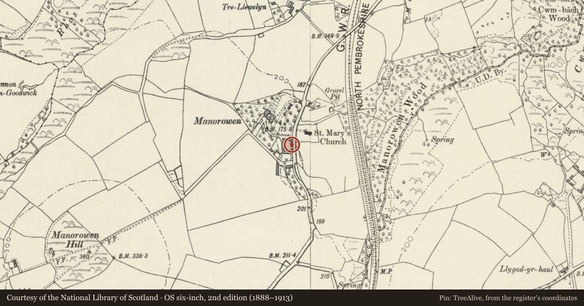
Slide toward Today to fade the historical sheet and see the modern map underneath.
David Rumsey Map Collection, Stanford LibrariesDavid Rumsey Map Collection, Stanford LibrariesDavid Rumsey Map Collection, Stanford LibrariesDavid Rumsey Map Collection, Stanford LibrariesDavid Rumsey Map Collection, Stanford Libraries
5 historical maps cover this location, the earliest the 1608 map "(13) Cambriae Typus." (David Rumsey Map Collection, Stanford Libraries).
Historical maps covering this location
- 1608 · (13) Cambriae Typus. (David Rumsey Map Collection, Stanford Libraries)
- 1891 · Sheet 10. Ordnance Survey of England and Wales. . (David Rumsey Map Collection, Stanford Libraries)
- 1898 · 210 Cardigan (Hills) (David Rumsey Map Collection, Stanford Libraries)
- 1898 · 210 Cardigan (Outline) (David Rumsey Map Collection, Stanford Libraries)
- 1901 · Sheet 13. (David Rumsey Map Collection, Stanford Libraries)
Cadw's description
Location
Situated just to S of Manorowen House, some 1.25 km S of Goodwick on the A487.
History
Probably late C18 or early C19 farm buildings marked on 1837 Tithe map.
Exterior
Late C18 or early C19 L shaped range of tack room, stables and cart/coach sheds on N and cow house on E. Together with the S and W range, these buildings enclose a rectangular farmyard. The N front is colourwashed roughcast with grouted slate roof. Small chimney on E end. Six small louvered windows to loft. On ground floor N front, E to W, are three small windows with stone arches, a single doorway with similar arch, and three large cart/coach doors; the central opening with a stone arch and the two others with a horizontal beam. The W end has outside steps to loft door.
Interior
The interior has turned wooden posts supporting the central beam. Rear of N range has rubble stone steps to loft and lean-to with 2 doors. Loft over stable has 12 bay pegged collar truss roof.
E range (N to S) cow house with 5 doors with slate lintels and 10 bay pegged collar truss roof.
Reason for designation
With the S and W range included for group value with Manorowen House, St Mary's Church, the walled garden and the gazebo.
Nearby in the register
- Home Farm Buildings, Manorwen north range.Agriculture and Subsistenceunder 1 mi
- Home Farm BuildingsAgriculture and Subsistenceunder 1 mi
- Home Farm Buildings Manorwen South RangeAgriculture and Subsistenceunder 1 mi
- St Marys ChurchReligious, Ritual and Funeraryunder 1 mi
Other entries of the same register within about three miles of this one, by straight line.