Cof Cymru: National Historic Assets of Wales · Wales
Hafod
Manordeilo and Salem, Carmarthenshire, Wales
A Grade II listed building in Salem, Manordeilo and Salem, Carmarthenshire, designated on 13 February 1995.
The record
- Designation
- Listed building, Grade II
- Broad class
- Domestic
- Date of designation
- 13 February 1995
- Locality
- Salem
- Community
- Manordeilo and Salem
- Unitary authority
- Carmarthenshire
- Country
- Wales
- Coordinates
- 51.92188, -4.01417
- Cadw reference
- 15186
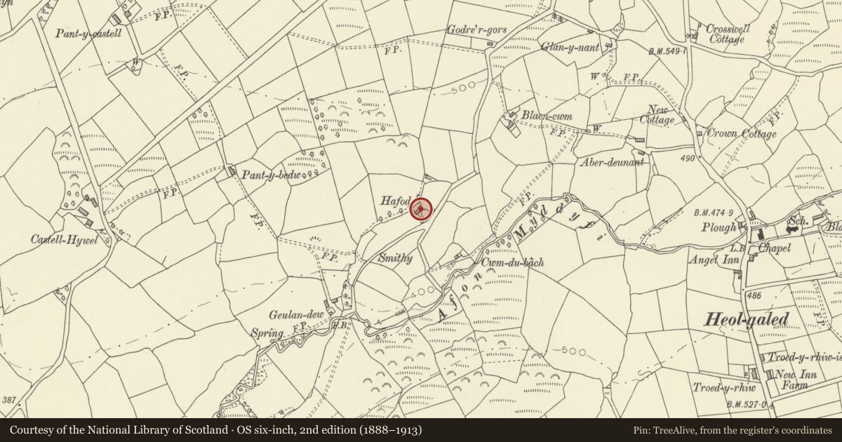
Slide toward Today to fade the historical sheet and see the modern map underneath.
David Rumsey Map Collection, Stanford LibrariesDavid Rumsey Map Collection, Stanford LibrariesDavid Rumsey Map Collection, Stanford LibrariesDavid Rumsey Map Collection, Stanford LibrariesDavid Rumsey Map Collection, Stanford Libraries
5 historical maps cover this location, the earliest the 1860 map "41. Caermathen." (David Rumsey Map Collection, Stanford Libraries).
Historical maps covering this location
- 1860 · 41. Caermathen. (David Rumsey Map Collection, Stanford Libraries)
- 1891 · Sheet 10. Ordnance Survey of England and Wales. . (David Rumsey Map Collection, Stanford Libraries)
- 1898 · 212 Llandovery (Outline) (David Rumsey Map Collection, Stanford Libraries)
- 1898 · 212 Llandovery (Hills) (David Rumsey Map Collection, Stanford Libraries)
- 1901 · Sheet 14. (David Rumsey Map Collection, Stanford Libraries)
Cadw's description
Location
Situated some 600m down dead-end lane, from junction some 300m W of Crosswell crossroads, N of Salem.
History
Late C18 or early Cl9 small farmhouse, marked on 1841 Tithe Map.
Exterior
Whitewashed render with corrugated iron roofs, and end-wall stacks, large brick left stack, smaller rendered right stack. Single storey, double-fronted off-centre facade, with four-pane sash each side of ledged door. Attached to left is lower byre, whitewashed rubble with corrugated-iron roof and two ledged doors. Small loop to centre. Timber lintels, the left door set lower due to slope.
Interior
Interior not accessible
Reason for designation
One of the least altered smaller traditional houses in the area, probably formerly thatched.
Nearby in the register
- Attached Byre to left of HafodAgriculture and Subsistenceunder 1 mi
- Outbuilding to SW of HafodAgriculture and Subsistenceunder 1 mi
- Salem Independent ChapelReligious, Ritual and Funeraryunder 1 mi
- RhydygwyddNo class recordedunder 1 mi
Other entries of the same register within about three miles of this one, by straight line.