Cof Cymru: National Historic Assets of Wales · Wales
Pistyllmarch
Manordeilo and Salem, Carmarthenshire, Wales
A Grade II listed building in Capel Isaac, Manordeilo and Salem, Carmarthenshire, designated on 13 February 1995.
The record
- Designation
- Listed building, Grade II
- Broad class
- Domestic
- Date of designation
- 13 February 1995
- Locality
- Capel Isaac
- Community
- Manordeilo and Salem
- Unitary authority
- Carmarthenshire
- Country
- Wales
- Coordinates
- 51.92808, -4.06192
- Cadw reference
- 15180
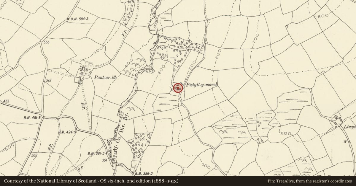
Slide toward Today to fade the historical sheet and see the modern map underneath.
David Rumsey Map Collection, Stanford LibrariesDavid Rumsey Map Collection, Stanford LibrariesDavid Rumsey Map Collection, Stanford LibrariesDavid Rumsey Map Collection, Stanford LibrariesDavid Rumsey Map Collection, Stanford Libraries
5 historical maps cover this location, the earliest the 1860 map "41. Caermathen." (David Rumsey Map Collection, Stanford Libraries).
Historical maps covering this location
- 1860 · 41. Caermathen. (David Rumsey Map Collection, Stanford Libraries)
- 1891 · Sheet 10. Ordnance Survey of England and Wales. . (David Rumsey Map Collection, Stanford Libraries)
- 1898 · 212 Llandovery (Hills) (David Rumsey Map Collection, Stanford Libraries)
- 1898 · 212 Llandovery (Outline) (David Rumsey Map Collection, Stanford Libraries)
- 1901 · Sheet 14. (David Rumsey Map Collection, Stanford Libraries)
Cadw's description
Location
Situated up track of some 650m running N from Brynmelyn Farm, some 400m E of Capel Isaac.
History
Mid to later C18 small farmhouse, marked on 1841 Tithe Map as of 63 acres, owned by Sir William Mansell, occupied by William Harris.
Exterior
Whitewashed rubble stone with corrugated iron roof over thatch. One storey and loft, rendered end stacks, larger to W. South front, facing into bank has two 4-pane sashes to ground floor and one tiny 4-pane casement above left window, breaking eaves. E end loft light. Rear rubble lean-to with two windows. Byre attached to W with opposed doors and door to house within, rendered brick centre stack. Two further doors on E side.
Interior
Heavy fireplace beam at N end. Said to have large roof trusses and surviving thatch.
Reason for designation
A good example of smaller traditional farmhouse with end-entry by chimney-stack.
Nearby in the register
- NantyffinDomestic1 mi
- Church of St EgwadReligious, Ritual and Funerary2 mi
- Telephone Call-box on S side of Llanfynydd churchyardCommunications2 mi
- PortisDomestic2 mi
Other entries of the same register within about three miles of this one, by straight line.