Cof Cymru: National Historic Assets of Wales · Wales
White House
Erbistock, Wrexham, Wales
A Grade II listed building in Eyton, Erbistock, Wrexham, designated on 13 February 1995.
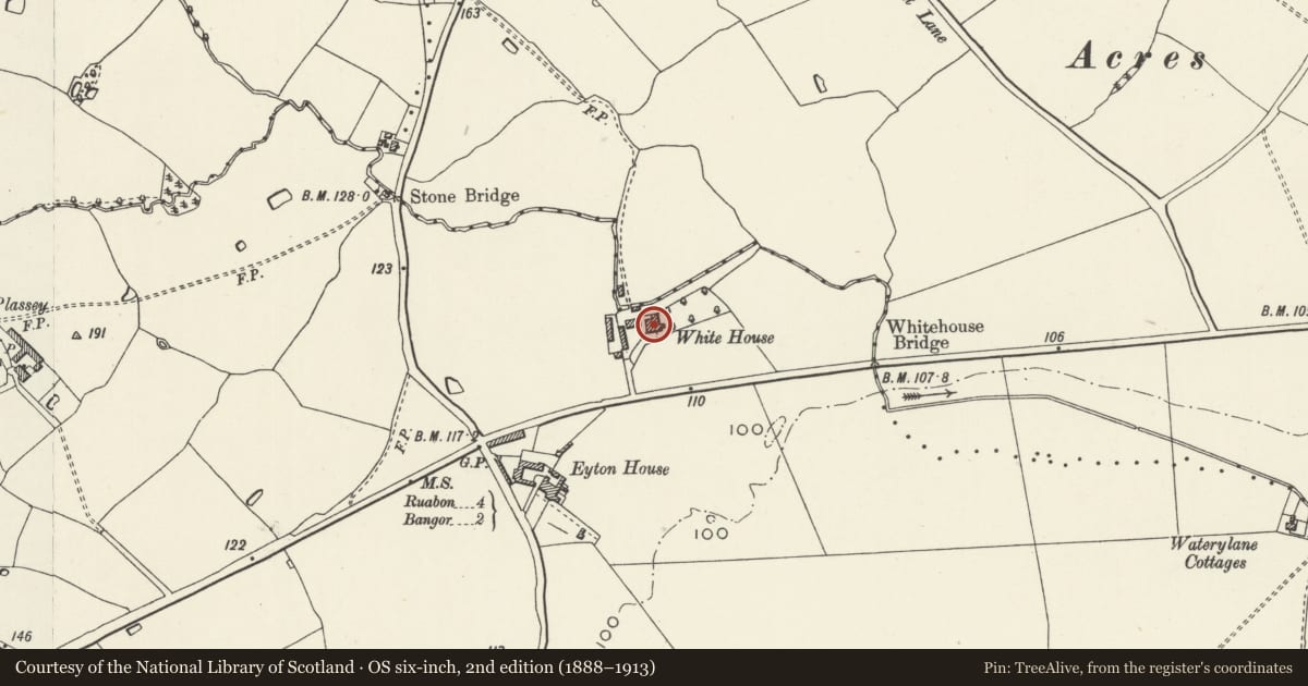
The record
- Designation
- Listed building, Grade II
- Broad class
- Domestic
- Date of designation
- 13 February 1995
- Locality
- Eyton
- Community
- Erbistock
- Unitary authority
- Wrexham
- Country
- Wales
- Coordinates
- 53.00101, -2.95679
- Cadw reference
- 15171
Slide toward Today to fade the historical sheet and see the modern map underneath.
David Rumsey Map Collection, Stanford LibrariesDavid Rumsey Map Collection, Stanford LibrariesDavid Rumsey Map Collection, Stanford LibrariesDavid Rumsey Map Collection, Stanford LibrariesDavid Rumsey Map Collection, Stanford Libraries
5 historical maps cover this location, the earliest the 1608 map "(13) Cambriae Typus." (David Rumsey Map Collection, Stanford Libraries).
Historical maps covering this location
- 1608 · (13) Cambriae Typus. (David Rumsey Map Collection, Stanford Libraries)
- 1637 · Particular description of Wales. Cambria seu Wallia (David Rumsey Map Collection, Stanford Libraries)
- 1883 · Watershed map England, Wales 3. (David Rumsey Map Collection, Stanford Libraries)
- 1898 · 121 Wrexham (Hills) (David Rumsey Map Collection, Stanford Libraries)
- 1901 · Sheet 9 and 10. (David Rumsey Map Collection, Stanford Libraries)
Cadw's description
Location
Situated on the N side of the B5426, 200m E of its junction with the A528.
History
Early C19 farmhouse incorporating part of an early C18 structure.
Exterior
2-storey 3 windows, brown brick now painted white, hipped tile roof. Front elevation: advanced central splayed bay containing entrance, ground floor windows with lintels painted black, later door with with clear fanlight. First floor 3 6-pane sash windows. To rear remains of former cruciform red brick range of early C18 date, three wings survive. Massive central brick stack, slate roof, later brick additions. Many original window openings survive however all windows have been replaced from C19 onwards.
Interior
Early C18 section retains exposed chamfered and stopped beams, and evidence of large kitchen internal stack. Plank and latched doors throughout. Early C19 phase retains a number of good 4-panelled doors, simple stick baluster staircase.
Reason for designation
Listed for the surviving late C17/early C18 phase which retains a considerable amount of its original character and as a good local example of early C19 vernacular architecture.
Nearby in the register
- Manor Farmhouse (Also Known As Eyton Manor Farmhouse)Domesticunder 1 mi
- Ddol FarmhouseDomesticunder 1 mi
- Asney Park FarmhouseDomesticunder 1 mi
- Wood HouseDomestic1 mi
Other entries of the same register within about three miles of this one, by straight line.