Cof Cymru: National Historic Assets of Wales · Wales
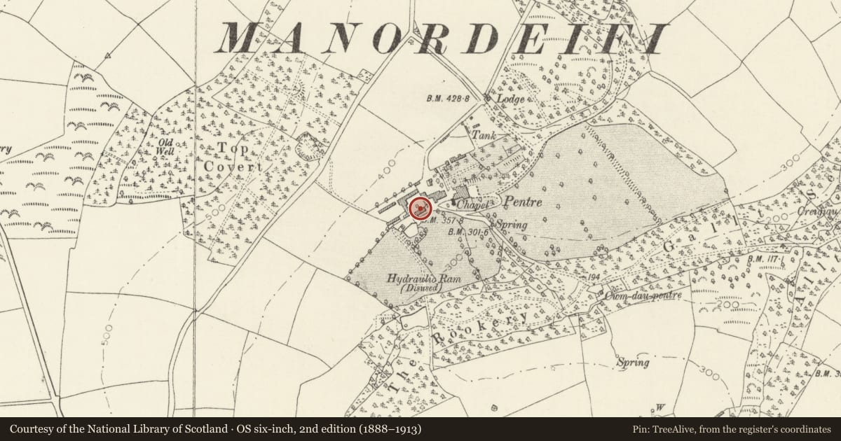
Range of Farm Buildings on S Side of yard at Pentre
Manordeifi, Pembrokeshire, Wales
A Grade II listed building in Pentre, Manordeifi, Pembrokeshire, designated on 24 November 1994.
The record
- Designation
- Listed building, Grade II
- Broad class
- Agriculture and Subsistence
- Date of designation
- 24 November 1994
- Locality
- Pentre
- Community
- Manordeifi
- Unitary authority
- Pembrokeshire
- Country
- Wales
- Coordinates
- 52.03805, -4.58070
- Cadw reference
- 15143
Slide toward Today to fade the historical sheet and see the modern map underneath.
David Rumsey Map Collection, Stanford LibrariesDavid Rumsey Map Collection, Stanford LibrariesDavid Rumsey Map Collection, Stanford LibrariesDavid Rumsey Map Collection, Stanford LibrariesDavid Rumsey Map Collection, Stanford Libraries
5 historical maps cover this location, the earliest the 1608 map "(13) Cambriae Typus." (David Rumsey Map Collection, Stanford Libraries).
Historical maps covering this location
- 1608 · (13) Cambriae Typus. (David Rumsey Map Collection, Stanford Libraries)
- 1636 · Cornubia : Devonia, Somersetus, Dorcestria, Wiltonia, Glocestria ... (David Rumsey Map Collection, Stanford Libraries)
- 1830 · V.3:11-15:XV. Britisches Reich. A. Kon: England. b. Frstenthum Wales: Shire: 37-40 (David Rumsey Map Collection, Stanford Libraries)
- 1891 · Sheet 10. Ordnance Survey of England and Wales. . (David Rumsey Map Collection, Stanford Libraries)
- 1898 · 211 Newcastle Emlyn (Hills) (David Rumsey Map Collection, Stanford Libraries)
Cadw's description
Location
Situated along S side of farm court at Pentre Farm, W of mansion.
History
Mid C19 range of farm buildings, apparently not marked on 1843 Tithe Map, though a range is marked on 1842-3 one inch O.S map. Apparently originally designed as open cart-sheds, the range was altered to stables in later C19. Pentre was owned by the Saunders-Davies family.
Exterior
Mid and late C19 range of buildings, originally probably cart-sheds, altered to stables. Single-storey, rubble stone with slate roof and three cross-gabled ridge vents. Window and door to left, then two cart-entries with cambered heads and stone pier between. Cut stone removed, though piers remain, three stable doors and one blank bay, then further stable door to right. W end has remains of an additional with one later work at Pentre Farm. Rear is outshut with five stable doors opening onto formerly enclosed yard with remains of arched entry at E end. Rear SW angle is chamfered, E end has windows, blocked door and window, and circular opening in gable.
Reason for designation
Part of unusually and complete group of C19 farm buildings.
Nearby in the register
- Building in Centre of Pentre FarmyardAgriculture and Subsistenceunder 1 mi
- Farm Building Range on E Side of Yard at Pentre FarmAgriculture and Subsistenceunder 1 mi
- Farm Buildings on West Side of Yard at Pentre FarmDomesticunder 1 mi
- Farm Buildings to North side of Yard at Pentre FarmDomesticunder 1 mi
Other entries of the same register within about three miles of this one, by straight line.