Cof Cymru: National Historic Assets of Wales · Wales
Terrace, Walls and Balustrades S of Ffynone
Manordeifi, Pembrokeshire, Wales
A Grade II* listed building in Manordeifi, Pembrokeshire, designated on 24 November 1994.
The record
- Designation
- Listed building, Grade II*
- Broad class
- Domestic
- Date of designation
- 24 November 1994
- Community
- Manordeifi
- Unitary authority
- Pembrokeshire
- Country
- Wales
- Coordinates
- 52.01778, -4.56276
- Cadw reference
- 15123
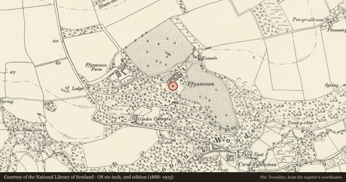
Slide toward Today to fade the historical sheet and see the modern map underneath.
David Rumsey Map Collection, Stanford LibrariesDavid Rumsey Map Collection, Stanford LibrariesDavid Rumsey Map Collection, Stanford LibrariesDavid Rumsey Map Collection, Stanford LibrariesDavid Rumsey Map Collection, Stanford Libraries
5 historical maps cover this location, the earliest the 1636 map "Cornubia : Devonia, Somersetus, Dorcestria, Wiltonia, Glocestria ..." (David Rumsey Map Collection, Stanford Libraries).
Historical maps covering this location
- 1636 · Cornubia : Devonia, Somersetus, Dorcestria, Wiltonia, Glocestria ... (David Rumsey Map Collection, Stanford Libraries)
- 1830 · V.3:11-15:XV. Britisches Reich. A. Kon: England. b. Frstenthum Wales: Shire: 37-40 (David Rumsey Map Collection, Stanford Libraries)
- 1891 · Sheet 10. Ordnance Survey of England and Wales. . (David Rumsey Map Collection, Stanford Libraries)
- 1898 · 211 Newcastle Emlyn (Hills) (David Rumsey Map Collection, Stanford Libraries)
- 1901 · Sheet 14. (David Rumsey Map Collection, Stanford Libraries)
Cadw's description
Location
Situated immediately below S front of the house.
History
1902-7 by F Inigo Thomas for J V Colby, part of the Edwardian remodelling of Ffynone, intended as the uppermost of three terraces.
Exterior
Long paved terrace with rubble stone curved-walled end features. Slate front balustrade in seven bays, the centre broken forward, moulded plinth and rail, turned balusters. Urn and steps down to garden each end. W exedra has curving high coped rubble wall between massive moulded slate rusticated piers carrying very fine large ashlar urns on corniced pedestals. Coped rubble wall ramped down to S and rubble coped terrace wall returning E to W end of house. E exedra has similar coped rubble curved wall, two similar flanking piers with urns, one built into corner of service range, but enfolds a formal pool with square stepping stones across to curved slate steps leading to archway through to a terrace beyond. The arch head rises above wall with slate cut voussoirs and curved coping. Terrace paving is of diagonally-laid squares with slate edging.
The E arch aligns with the decoratively treated W end of a service range, roughcast with massive Cilgerran stone rustication to an arched recess.
Reason for designation
Graded II* as one of the best Edwardian architectural garden features in Wales.
Nearby in the register
- FfynoneDomesticunder 1 mi
- Sundial on W Lawn at FfynoneGardens, Parks and Urban Spacesunder 1 mi
- Terrace Wall and Balustrade to W Garden at FfynoneDomesticunder 1 mi
- Stable and Kitchen CourtDomesticunder 1 mi
Other entries of the same register within about three miles of this one, by straight line.