Cof Cymru: National Historic Assets of Wales · Wales
Former Shambles
Hawarden, Flintshire, Wales
A Grade II listed building in Hawarden, Flintshire, designated on 16 November 1994.
The record
- Designation
- Listed building, Grade II
- Broad class
- Domestic
- Date of designation
- 16 November 1994
- Community
- Hawarden
- Unitary authority
- Flintshire
- Country
- Wales
- Coordinates
- 53.18458, -3.02482
- Cadw reference
- 15063
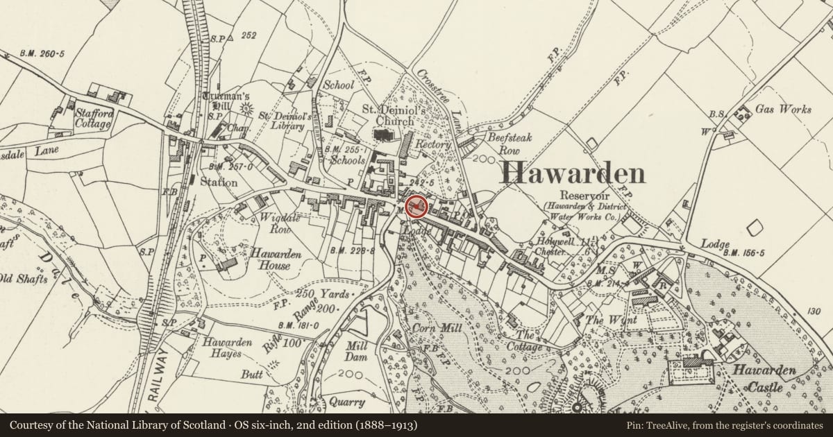
Slide toward Today to fade the historical sheet and see the modern map underneath.
David Rumsey Map Collection, Stanford LibrariesDavid Rumsey Map Collection, Stanford LibrariesDavid Rumsey Map Collection, Stanford LibrariesDavid Rumsey Map Collection, Stanford LibrariesLlyfrgell Genedlaethol Cymru – The National Library of Wales
5 historical maps cover this location, the earliest the 1795 map "To Sir Watkin Williams-Wynn Bart ... the map of the six counties of North Wales is most humbly inscribed by his obedient humble servant" (Llyfrgell Genedlaethol Cymru – The National Library of Wales).
Historical maps covering this location
- 1795 · To Sir Watkin Williams-Wynn Bart ... the map of the six counties of North Wales is most… (Llyfrgell Genedlaethol Cymru – The National Library of Wales)
- 1883 · Watershed map England, Wales 3. (David Rumsey Map Collection, Stanford Libraries)
- 1898 · 108 Flint (Hills) (David Rumsey Map Collection, Stanford Libraries)
- 1898 · 108 Flint (Outline) (David Rumsey Map Collection, Stanford Libraries)
- 1901 · Sheet 9 and 10. (David Rumsey Map Collection, Stanford Libraries)
Cadw's description
Location
Adjoining the Glynne Arms to the E.
Exterior
A pair of large, plain early C19 gate piers with flanking single-storey lodges. Of sandstone, that to the E has brick dentilated eaves to the rear.
The street facades of these were refaced in the third quarter C19 to form a series of arcaded units with Tudor arches, four to the W and two to the E of the gate piers. These were used as shambles, and housed butchers' shops into early this century. Cattle markets were held in the Inn courtyard during the late C19. Of red brick with yellow brick detailing. Coped parapet with moulded brackets. Chamfered arches and reveals, with plain abaci at springing. Plain plinths and simple decorative brick banding to arcade piers.
The 2 right-hand units to the W are open and since 1953 have been a bus shelter. Within, set into the wall, a stone plaque commemorating the coronation of Queen Elizabeth II giving foundation details.
Reason for designation
Group value with the Glynne Arms.
Nearby in the register
- 4 Glynne WayDomesticunder 1 mi
- 6 Glynne WayDomesticunder 1 mi
- The Glynne Arms PHCommercialunder 1 mi
- 8 Glynne WayDomesticunder 1 mi
Other entries of the same register within about three miles of this one, by straight line.