Cof Cymru: National Historic Assets of Wales · Wales
Gate Lodge
Hawarden, Flintshire, Wales
A Grade II listed building in Hawarden, Flintshire, designated on 16 November 1994.
The record
- Designation
- Listed building, Grade II
- Broad class
- Domestic
- Date of designation
- 16 November 1994
- Community
- Hawarden
- Unitary authority
- Flintshire
- Country
- Wales
- Coordinates
- 53.18431, -3.02490
- Cadw reference
- 15030
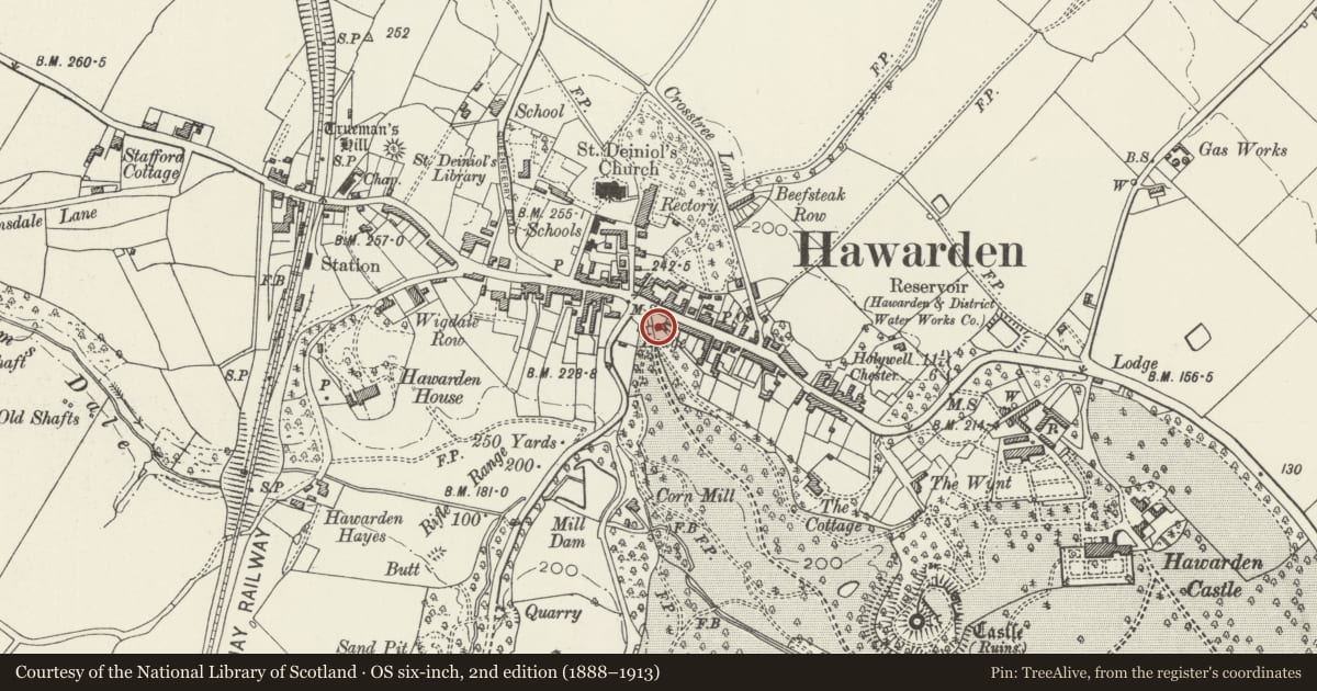
Slide toward Today to fade the historical sheet and see the modern map underneath.
David Rumsey Map Collection, Stanford LibrariesDavid Rumsey Map Collection, Stanford LibrariesDavid Rumsey Map Collection, Stanford LibrariesDavid Rumsey Map Collection, Stanford LibrariesLlyfrgell Genedlaethol Cymru – The National Library of Wales
5 historical maps cover this location, the earliest the 1795 map "To Sir Watkin Williams-Wynn Bart ... the map of the six counties of North Wales is most humbly inscribed by his obedient humble servant" (Llyfrgell Genedlaethol Cymru – The National Library of Wales).
Historical maps covering this location
- 1795 · To Sir Watkin Williams-Wynn Bart ... the map of the six counties of North Wales is most… (Llyfrgell Genedlaethol Cymru – The National Library of Wales)
- 1883 · Watershed map England, Wales 3. (David Rumsey Map Collection, Stanford Libraries)
- 1898 · 108 Flint (Hills) (David Rumsey Map Collection, Stanford Libraries)
- 1898 · 108 Flint (Outline) (David Rumsey Map Collection, Stanford Libraries)
- 1901 · Sheet 9 and 10. (David Rumsey Map Collection, Stanford Libraries)
Cadw's description
Location
Within the park, behind gateway and abutting to E.
Exterior
A single-storey stone-built castellated gatelodge, associated with the gateway and attributable to John Buckler. Built c.1819. Flat roof with two squat chimneys. The building advances in 3 bays from R - L. Central plain chamfered doorway with later, simple shallow pediment. Modern door. 2 and 3-light leaded windows, 6 panes to a light. That of the L bay has moulded, returned label. Crenellated parapet with moulded coping. Ashlar quoins.
Reason for designation
Group value with the Gateway.
Nearby in the register
- Entrance Gate to Hawarden CastleDomesticunder 1 mi
- 4 Glynne WayDomesticunder 1 mi
- 6 Glynne WayDomesticunder 1 mi
- 8 Glynne WayDomesticunder 1 mi
Other entries of the same register within about three miles of this one, by straight line.