Cof Cymru: National Historic Assets of Wales · Wales
Former Smithy and Engine-House at Bodrhyddan Home Farm
Rhuddlan, Denbighshire, Wales
A Grade II listed building in bodrhyddan, Rhuddlan, Denbighshire, designated on 10 November 1994.
The record
- Designation
- Listed building, Grade II
- Broad class
- Domestic
- Date of designation
- 10 November 1994
- Locality
- bodrhyddan
- Community
- Rhuddlan
- Unitary authority
- Denbighshire
- Country
- Wales
- Coordinates
- 53.29573, -3.43322
- Cadw reference
- 15008
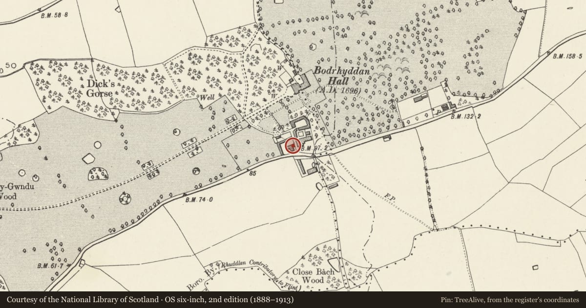
Slide toward Today to fade the historical sheet and see the modern map underneath.
David Rumsey Map Collection, Stanford LibrariesDavid Rumsey Map Collection, Stanford LibrariesNational Library of ScotlandDavid Rumsey Map Collection, Stanford LibrariesLlyfrgell Genedlaethol Cymru – The National Library of Wales
5 historical maps cover this location, the earliest the 1795 map "To Sir Watkin Williams-Wynn Bart ... the map of the six counties of North Wales is most humbly inscribed by his obedient humble servant" (Llyfrgell Genedlaethol Cymru – The National Library of Wales).
Historical maps covering this location
- 1795 · To Sir Watkin Williams-Wynn Bart ... the map of the six counties of North Wales is most… (Llyfrgell Genedlaethol Cymru – The National Library of Wales)
- 1883 · Watershed map England, Wales 3. (David Rumsey Map Collection, Stanford Libraries)
- 1898 · 95 Rhyl (Hills) (David Rumsey Map Collection, Stanford Libraries)
- 1901 · Sheet 9 and 10. (David Rumsey Map Collection, Stanford Libraries)
- 1963 · Map No. 36 - Local Government Commission for Wales : [Definitive maps showing proposed… (National Library of Scotland)
Cadw's description
Exterior
To the west of the driveway to the Home Farm, immediately to the N ~f Ffordd Ffranc (the Dyserth Road)~
Built as a smithy etc. in the mid C19, partly serving as engine house for the operation of farm machinery, and now used as a grain store. Rough rubble with slate roofs. 2-storeyed, L-plan, with tall square section chimney projecting from SE corner. Main elevation faces N and has wide segmentally arched entrances to either side, with 3 segmentally arched windows between them. These openings have now all been partially infilled, associated with a change of use. Windows in E and S elevations with stone ci 115 and lintels.
A good surviving example of a mid Cl9 farm-building, of particular interest for its connection with powered machinery.
Nearby in the register
- Gatepiers of former entrance to Bodwyddan HallDomesticunder 1 mi
- Stable Block at Bodrhyddan Home FarmDomesticunder 1 mi
- Former Cowhouse or Shelter-shed at Bodrhyddan Home FarmAgriculture and Subsistenceunder 1 mi
- Memorial Fountain at N end of Home Farm DrivewayCommemorativeunder 1 mi
Other entries of the same register within about three miles of this one, by straight line.