Cof Cymru: National Historic Assets of Wales · Wales
Chest Tomb to NE of Church of Saint Mary
Rhuddlan, Denbighshire, Wales
A Grade II listed building in Rhuddlan, Denbighshire, designated on 10 November 1994.
The record
- Designation
- Listed building, Grade II
- Broad class
- Religious, Ritual and Funerary
- Date of designation
- 10 November 1994
- Community
- Rhuddlan
- Unitary authority
- Denbighshire
- Country
- Wales
- Coordinates
- 53.29098, -3.46913
- Cadw reference
- 14978
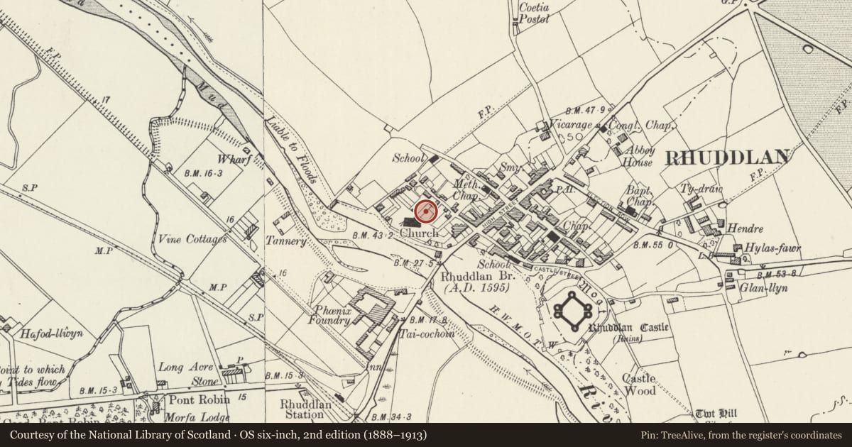
Slide toward Today to fade the historical sheet and see the modern map underneath.
David Rumsey Map Collection, Stanford LibrariesDavid Rumsey Map Collection, Stanford LibrariesNational Library of ScotlandDavid Rumsey Map Collection, Stanford LibrariesLlyfrgell Genedlaethol Cymru – The National Library of Wales
5 historical maps cover this location, the earliest the 1795 map "To Sir Watkin Williams-Wynn Bart ... the map of the six counties of North Wales is most humbly inscribed by his obedient humble servant" (Llyfrgell Genedlaethol Cymru – The National Library of Wales).
Historical maps covering this location
- 1795 · To Sir Watkin Williams-Wynn Bart ... the map of the six counties of North Wales is most… (Llyfrgell Genedlaethol Cymru – The National Library of Wales)
- 1883 · Watershed map England, Wales 3. (David Rumsey Map Collection, Stanford Libraries)
- 1898 · 95 Rhyl (Hills) (David Rumsey Map Collection, Stanford Libraries)
- 1901 · Sheet 9 and 10. (David Rumsey Map Collection, Stanford Libraries)
- 1963 · Map No. 36 - Local Government Commission for Wales : [Definitive maps showing proposed… (National Library of Scotland)
Cadw's description
Location
In the E angle of the chancel of the church and the mausoleum which projects to its N.
Exterior
Chest tomb, dated 1685, the inscription otherwise badly eroded and largely illegible. Inscribed slab with shield, and lettering running round the margins, carried on base with strapwork panels and guilloche with fluted shafts at angles and centre of each side.
Reason for designation
A good and rare example of late C17 memorial sculpture.
Nearby in the register
- Church of Saint MaryReligious, Ritual and Funeraryunder 1 mi
- Churchyard CrossReligious, Ritual and Funeraryunder 1 mi
- 1. Chest Tomb to SE of Church of Saint MaryReligious, Ritual and Funeraryunder 1 mi
- 2. Chest Tomb to SE of Church of Church of Saint MaryReligious, Ritual and Funeraryunder 1 mi
Other entries of the same register within about three miles of this one, by straight line.