Cof Cymru: National Historic Assets of Wales · Wales
Former Farmhouse at Castell Farmyard
Dinas Cross, Pembrokeshire, Wales
A Grade II listed building in Penrhyn, Dinas Cross, Pembrokeshire, designated on 17 November 1994.
The record
- Designation
- Listed building, Grade II
- Broad class
- Domestic
- Date of designation
- 17 November 1994
- Locality
- Penrhyn
- Community
- Dinas Cross
- Unitary authority
- Pembrokeshire
- Country
- Wales
- Coordinates
- 52.00178, -4.94486
- Cadw reference
- 14951
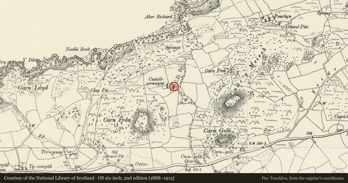
Slide toward Today to fade the historical sheet and see the modern map underneath.
David Rumsey Map Collection, Stanford LibrariesDavid Rumsey Map Collection, Stanford LibrariesDavid Rumsey Map Collection, Stanford LibrariesDavid Rumsey Map Collection, Stanford LibrariesDavid Rumsey Map Collection, Stanford Libraries
5 historical maps cover this location, the earliest the 1608 map "(13) Cambriae Typus." (David Rumsey Map Collection, Stanford Libraries).
Historical maps covering this location
- 1608 · (13) Cambriae Typus. (David Rumsey Map Collection, Stanford Libraries)
- 1891 · Sheet 10. Ordnance Survey of England and Wales. . (David Rumsey Map Collection, Stanford Libraries)
- 1898 · 210 Cardigan (Hills) (David Rumsey Map Collection, Stanford Libraries)
- 1898 · 210 Cardigan (Outline) (David Rumsey Map Collection, Stanford Libraries)
- 1901 · Sheet 13. (David Rumsey Map Collection, Stanford Libraries)
Cadw's description
Location
Situated some 0.5 km N of A487 on lane to Penrhyn Ychen head (Fishguard Bay Caravan Park), the old house backing onto the road.
History
Earlier C19 farmhouse, used for storage since new house was built in 1913.
Exterior
Cement washed rubble stone with heavily grouted slate roof and stone end stacks, larger to right. Single storey and loft, double fronted with ledged door and window to each side. Painted brick heads. Single storey SW outbuilding added to right of front, at right angles, as coal house and wash-house. North end tiny loft light, rear added outshut with N end door and rear window and door. South end outbuilding with grouted roof, matching ridge height and rear broad entry with double doors and timber lintel, door to front.
Interior
Entry to kitchen with S end timber-lintel fireplace and whitewashed pine partition to N end parlour. Ladder access to original crogloft over parlour, and some later inserted flooring over kitchen.
Reason for designation
Included as a good and little-altered example of a single-storey farmhouse of the area, few of which remain with original features.
Nearby in the register
- Inscribed Stone 130m E of PenwaunCrossunder 1 mi
- Plas Glyn-y-Mel, including quadrant wall & gatepier to W service courtDomesticunder 1 mi
- Ty-Meini Standing StoneStanding Stone1 mi
- Glyn-y-Mel Cottage (Cwm Cwsgi)Domestic1 mi
Other entries of the same register within about three miles of this one, by straight line.