Cof Cymru: National Historic Assets of Wales · Wales
Hearse House at Church of St Mary (Including Churchyard Walls and Lych Gate
Cilcain, Flintshire, Wales
A Grade II listed building in Cilcain, Flintshire, designated on 16 October 1995.
The record
- Designation
- Listed building, Grade II
- Broad class
- Religious, Ritual and Funerary
- Date of designation
- 16 October 1995
- Town
- Cilcain
- Community
- Cilcain
- Unitary authority
- Flintshire
- Country
- Wales
- Coordinates
- 53.17691, -3.23378
- Cadw reference
- 14918
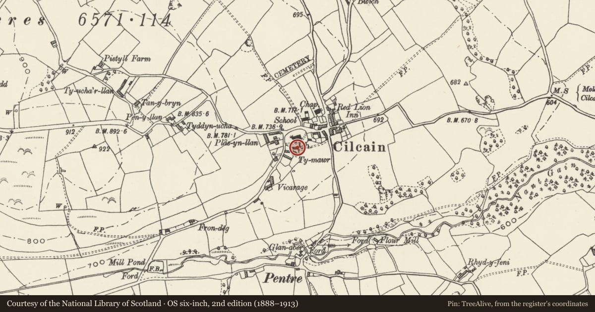
Slide toward Today to fade the historical sheet and see the modern map underneath.
David Rumsey Map Collection, Stanford LibrariesDavid Rumsey Map Collection, Stanford LibrariesDavid Rumsey Map Collection, Stanford LibrariesLlyfrgell Genedlaethol Cymru – The National Library of WalesDavid Rumsey Map Collection, Stanford Libraries
5 historical maps cover this location, the earliest the 1795 map "To Sir Watkin Williams-Wynn Bart ... the map of the six counties of North Wales is most humbly inscribed by his obedient humble servant" (Llyfrgell Genedlaethol Cymru – The National Library of Wales).
Historical maps covering this location
- 1795 · To Sir Watkin Williams-Wynn Bart ... the map of the six counties of North Wales is most… (Llyfrgell Genedlaethol Cymru – The National Library of Wales)
- 1883 · Watershed map England, Wales 3. (David Rumsey Map Collection, Stanford Libraries)
- 1898 · 108 Flint (Hills) (David Rumsey Map Collection, Stanford Libraries)
- 1898 · 108 Flint (Outline) (David Rumsey Map Collection, Stanford Libraries)
- 1901 · Sheet 9 and 10. (David Rumsey Map Collection, Stanford Libraries)
Cadw's description
Location
Situated E of the Church of St Mary adjacent to the churchyard wall.
History
Built by Thomas Jones, architect of Chester, 1810.
Exterior
Rubble with roughly squared quoins, slate roof with red ridge tiles. Side on to street, right hand gabled return has opening with cambered timber lintel and boarded doors. Attached to the rear wall are rubble churchyard walls and a lych gate of traditional design.
Interior
Not accessible at time of 1995 survey.
Reason for designation
Listed as a good little-altered example of a hearse house of early C19 date. Group value with St. Mary's Church.
Nearby in the register
- Church of St MaryReligious, Ritual and Funeraryunder 1 mi
- Plas-yn-LlanDomesticunder 1 mi
- Barn at Plas-yn-LlanAgriculture and Subsistenceunder 1 mi
- The Old VicarageDomesticunder 1 mi
Other entries of the same register within about three miles of this one, by straight line.