Cof Cymru: National Historic Assets of Wales · Wales
Hillside
Old Colwyn, Conwy, Wales
A Grade II listed building in Old Colwyn, Conwy, designated on 9 September 1994.
The record
- Designation
- Listed building, Grade II
- Broad class
- Domestic
- Date of designation
- 9 September 1994
- Locality
- Old Colwyn
- Community
- Old Colwyn
- Unitary authority
- Conwy
- Country
- Wales
- Coordinates
- 53.28807, -3.70862
- Cadw reference
- 14855
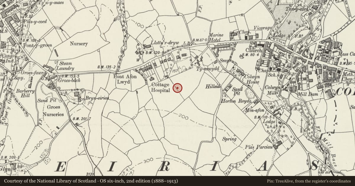
Slide toward Today to fade the historical sheet and see the modern map underneath.
David Rumsey Map Collection, Stanford LibrariesDavid Rumsey Map Collection, Stanford LibrariesNational Library of ScotlandDavid Rumsey Map Collection, Stanford LibrariesLlyfrgell Genedlaethol Cymru – The National Library of Wales
5 historical maps cover this location, the earliest the 1795 map "To Sir Watkin Williams-Wynn Bart ... the map of the six counties of North Wales is most humbly inscribed by his obedient humble servant" (Llyfrgell Genedlaethol Cymru – The National Library of Wales).
Historical maps covering this location
- 1795 · To Sir Watkin Williams-Wynn Bart ... the map of the six counties of North Wales is most… (Llyfrgell Genedlaethol Cymru – The National Library of Wales)
- 1883 · Watershed map England, Wales 3. (David Rumsey Map Collection, Stanford Libraries)
- 1898 · 95 Rhyl (Hills) (David Rumsey Map Collection, Stanford Libraries)
- 1900 · Denbighshire Sheet III.NE (National Library of Scotland)
- 1901 · Sheet 9 and 10. (David Rumsey Map Collection, Stanford Libraries)
Cadw's description
Location
Towards the junction with Hesketh Road.
History
Built in 1912 and designed by J M Porter and Elcock, architects of Colwyn Bay for a Miss Johns.
Exterior
Arts and crafts style. Roughcast render with some brick dressings, and plain tiled roofs with brick stacks. Small-paned casement windows throughout. Based on an L-plan, but with complex grouping of separately roofed blocks, the front elevation is dominated by a wide half-hipped gabled wing to the left, swept forward from the hipped roof of the central part of the house. The roof-line of this wing dips down low to each side, over a glazed sun-room to the right, and the small casement window of an inglenook to the left. Wide canted bay window to ground floor, and long 5-pane casement window immediately below the eaves line above. Bold overhang to eaves. Angled stack in the re-entrant angle, linked back to the roof-line of the wing by a small dormer. Entrance to right in separately roofed porch block: paired doors with strap hinges beneath canopy with moulded console brackets. 2-light casement window off-set above the doorway. Lower service wing set back to the right, behind a small enclosed courtyard.
Reason for designation
A good example of a small Arts and Crafts house, with lively, complex massing and all of its original detail.
Nearby in the register
- Llety'r DrywDomesticunder 1 mi
- Civic Centre (Former Glan y Don Hall)Domesticunder 1 mi
- Church of St CatherineReligious, Ritual and Funeraryunder 1 mi
- 3 Llawr PentreDomesticunder 1 mi
Other entries of the same register within about three miles of this one, by straight line.