Cof Cymru: National Historic Assets of Wales · Wales
Grianllyn Farmhouse
Mochdre, Conwy, Wales
A Grade II listed building in Mochdre, Conwy, designated on 9 September 1994.
The record
- Designation
- Listed building, Grade II
- Broad class
- Domestic
- Date of designation
- 9 September 1994
- Community
- Mochdre
- Unitary authority
- Conwy
- Country
- Wales
- Coordinates
- 53.28130, -3.75812
- Cadw reference
- 14842
Slide toward Today to fade the historical sheet and see the modern map underneath.
David Rumsey Map Collection, Stanford LibrariesDavid Rumsey Map Collection, Stanford LibrariesDavid Rumsey Map Collection, Stanford LibrariesLlyfrgell Genedlaethol Cymru – The National Library of WalesDavid Rumsey Map Collection, Stanford Libraries
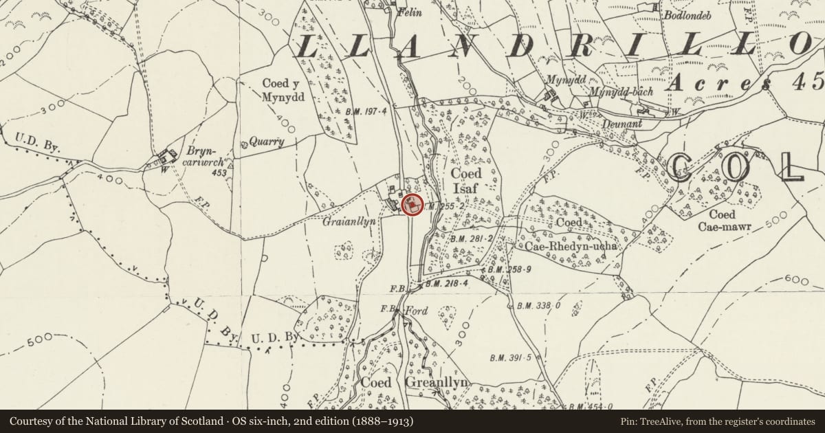
5 historical maps cover this location, the earliest the 1795 map "To Sir Watkin Williams-Wynn Bart ... the map of the six counties of North Wales is most humbly inscribed by his obedient humble servant" (Llyfrgell Genedlaethol Cymru – The National Library of Wales).
Historical maps covering this location
- 1795 · To Sir Watkin Williams-Wynn Bart ... the map of the six counties of North Wales is most… (Llyfrgell Genedlaethol Cymru – The National Library of Wales)
- 1830 · V.3:11-15:XV. Britisches Reich. A. Kon: England. b. Frstenthum Wales: Shire: 37-40 (David Rumsey Map Collection, Stanford Libraries)
- 1883 · Watershed map England, Wales 3. (David Rumsey Map Collection, Stanford Libraries)
- 1898 · 95 Rhyl (Hills) (David Rumsey Map Collection, Stanford Libraries)
- 1901 · Sheet 9 and 10. (David Rumsey Map Collection, Stanford Libraries)
Cadw's description
Location
Faces away from the road which separates the house from the farmyard, approx 1km from the centre of Mochdre.
Exterior
Probably mid C18, though later raised in height with the addition of an upper storey. 3 storeys to front, one storey with attic to rear. 3-window range with central entrance. 16-pane sash windows on each floor, and 2 dormer windows in the roof. Long outshut to rear (largely the result of alterations probably carried out at some time in the C19) has side entrance apparently giving access to separate labourers’ accommodation, and central door and inserted dormer windows in the rear. Curved bressumer to gable-end fireplace and heavy, chamfered axial beams inside.
Reason for designation
A good example of a vernacular farmhouse which forms part of a group with the barn at Grianllyn.
Nearby in the register
- Barn at Grianllyn Farm (W side)Agriculture and Subsistenceunder 1 mi
- HighlandsDomesticunder 1 mi
- Dyffryn CottageDomesticunder 1 mi
- Cefn Garlleg FarmhouseDomesticunder 1 mi
Other entries of the same register within about three miles of this one, by straight line.