Cof Cymru: National Historic Assets of Wales · Wales
3. Chest Tomb in St Trillo's Churchyard
Llandrillo-yn-Rhos / Rhos-on-Sea, Conwy, Wales
A Grade II listed building in Rhos on Sea, Llandrillo-yn-Rhos / Rhos-on-Sea, Conwy, designated on 9 September 1994.
The record
- Designation
- Listed building, Grade II
- Broad class
- Religious, Ritual and Funerary
- Date of designation
- 9 September 1994
- Locality
- Rhos on Sea
- Community
- Llandrillo-yn-Rhos / Rhos-on-Sea
- Unitary authority
- Conwy
- Country
- Wales
- Coordinates
- 53.30943, -3.75428
- Cadw reference
- 14831
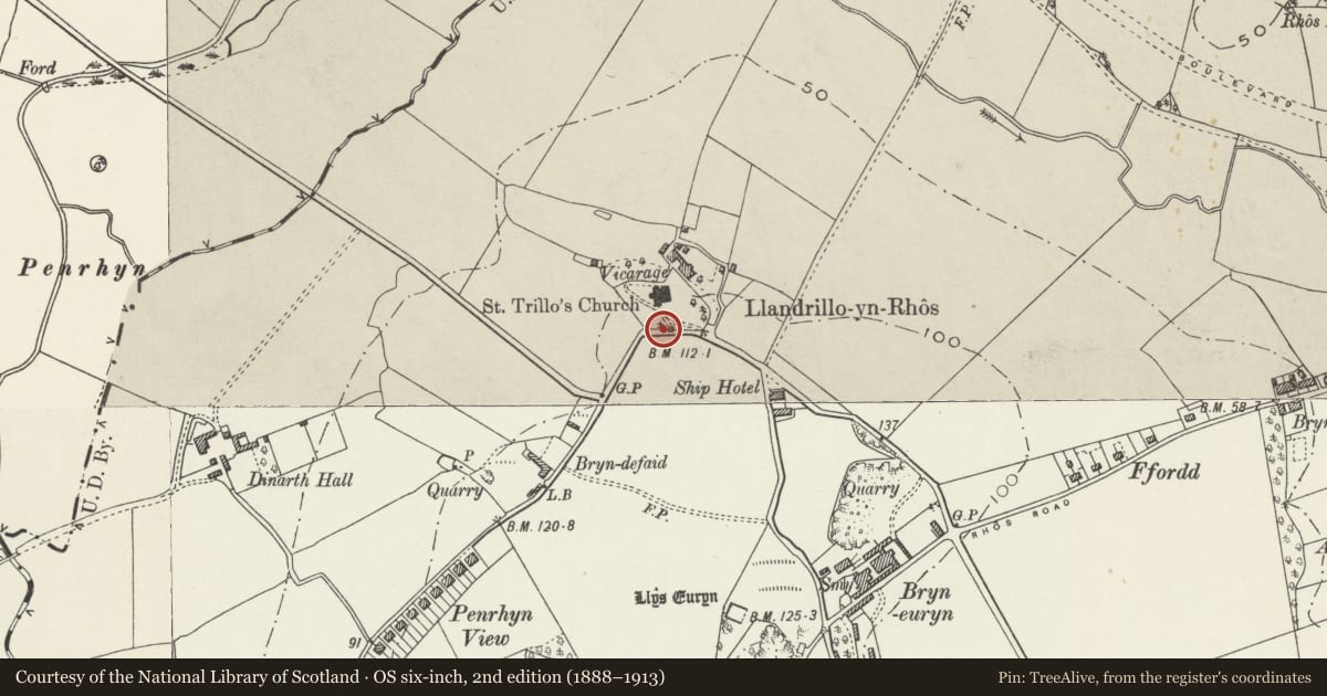
Slide toward Today to fade the historical sheet and see the modern map underneath.
David Rumsey Map Collection, Stanford LibrariesDavid Rumsey Map Collection, Stanford LibrariesDavid Rumsey Map Collection, Stanford LibrariesLlyfrgell Genedlaethol Cymru – The National Library of WalesNational Library of Scotland
5 historical maps cover this location, the earliest the 1795 map "To Sir Watkin Williams-Wynn Bart ... the map of the six counties of North Wales is most humbly inscribed by his obedient humble servant" (Llyfrgell Genedlaethol Cymru – The National Library of Wales).
Historical maps covering this location
- 1795 · To Sir Watkin Williams-Wynn Bart ... the map of the six counties of North Wales is most… (Llyfrgell Genedlaethol Cymru – The National Library of Wales)
- 1883 · Watershed map England, Wales 3. (David Rumsey Map Collection, Stanford Libraries)
- 1898 · 95 Rhyl (Hills) (David Rumsey Map Collection, Stanford Libraries)
- 1901 · Sheet 9 and 10. (David Rumsey Map Collection, Stanford Libraries)
- 1930 · OS Popular Edition 1919-1947 (National Library of Scotland)
Cadw's description
Location
Near the boundary wall of the churchyard, immediately adjacent to the path leading from the lychgate to the church porch.
Exterior
Group of 6 chest tombs, with commemoration dates from the period 1720 - 1799. Inscribed top slabs are carried on bases with fluted pilasters marking angles.
Reason for designation
A fine group of C18 chest tombs in the context of a churchyard which is rich in memorials. A significant component in the context of the Church of Saint Trillo.
Nearby in the register
- 1. Chest Tomb in St Trillo's ChurchyardReligious, Ritual and Funeraryunder 1 mi
- 2. Chest Tomb in St Trillo's ChurchyardReligious, Ritual and Funeraryunder 1 mi
- 4. Chest Tomb in St Trillo's ChurchyardReligious, Ritual and Funeraryunder 1 mi
- 5. Chest Tomb in St Trillo's ChurchyardReligious, Ritual and Funeraryunder 1 mi
Other entries of the same register within about three miles of this one, by straight line.