Cof Cymru: National Historic Assets of Wales · Wales
Pumping Station
Llandrillo-yn-Rhos / Rhos-on-Sea, Conwy, Wales
A Grade II listed building in Rhos on Sea, Llandrillo-yn-Rhos / Rhos-on-Sea, Conwy, designated on 9 September 1994.
The record
- Designation
- Listed building, Grade II
- Broad class
- Water Supply and Drainage
- Date of designation
- 9 September 1994
- Locality
- Rhos on Sea
- Community
- Llandrillo-yn-Rhos / Rhos-on-Sea
- Unitary authority
- Conwy
- Country
- Wales
- Coordinates
- 53.31259, -3.75004
- Cadw reference
- 14824
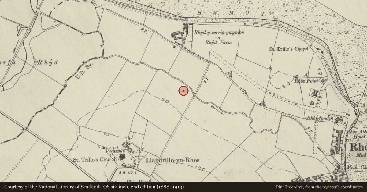
Slide toward Today to fade the historical sheet and see the modern map underneath.
David Rumsey Map Collection, Stanford LibrariesDavid Rumsey Map Collection, Stanford LibrariesDavid Rumsey Map Collection, Stanford LibrariesLlyfrgell Genedlaethol Cymru – The National Library of WalesNational Library of Scotland
5 historical maps cover this location, the earliest the 1795 map "To Sir Watkin Williams-Wynn Bart ... the map of the six counties of North Wales is most humbly inscribed by his obedient humble servant" (Llyfrgell Genedlaethol Cymru – The National Library of Wales).
Historical maps covering this location
- 1795 · To Sir Watkin Williams-Wynn Bart ... the map of the six counties of North Wales is most… (Llyfrgell Genedlaethol Cymru – The National Library of Wales)
- 1883 · Watershed map England, Wales 3. (David Rumsey Map Collection, Stanford Libraries)
- 1898 · 95 Rhyl (Hills) (David Rumsey Map Collection, Stanford Libraries)
- 1901 · Sheet 9 and 10. (David Rumsey Map Collection, Stanford Libraries)
- 1930 · OS Popular Edition 1919-1947 (National Library of Scotland)
Cadw's description
History
Outer pumping station, built c1900-1910.
Exterior
Red brick with buff faience dressings, slate roof with tiled cresting, and raised louvred clerestories. Single storeyed, a long building of 2 parallel gabled ranges, with gabled wing advanced from N side, and a further extension (the boiler house?) from the NW. Paired gables face SE, each pedimented with modillion cornice; entrance in the wider and higher left hand gable. Segmentally arched doorway with heavy moulded hood. Pilasters mark the outer angles of the gables, and have capitals with swags in relief, and moulded volutes above egg and dart cornice. 2-bay return elevation to N divided by similarly enriched pilaster buttresses, and with a segmentally arched window in each bay. These have exaggerated splayed voussoir heads, and continuous impost band. Advanced wing is also articulated by enriched pilaster buttresses, and has narrow ventilation lights in two rows between plain terracotta bands, set high up on each side. Segmental pediment surmounted by a stack to gable. Continuation of main range beyond is a further 2 bays, detailed as before. Similar detail in long S-facing elevation. Lower rear wing has stack at angle, and simpler decorative detail.
Reason for designation
A good example of a pumping station building of the early C20 which uses a flamboyant architectural vocabularly to stress its public or civic purpose.
Nearby in the register
- St Trillo's VicarageDomesticunder 1 mi
- Church of St TrilloReligious, Ritual and Funeraryunder 1 mi
- Sundial in St Trillo's ChruchyardGardens, Parks and Urban Spacesunder 1 mi
- Lychgate of Church of St TrilloReligious, Ritual and Funeraryunder 1 mi
Other entries of the same register within about three miles of this one, by straight line.