Cof Cymru: National Historic Assets of Wales · Wales
Miners Welfare Hall
Ammanford, Carmarthenshire, Wales
A Grade II listed building in Ammanford, Carmarthenshire, designated on 10 August 1994.
The record
- Designation
- Listed building, Grade II
- Broad class
- Recreational
- Date of designation
- 10 August 1994
- Community
- Ammanford
- Unitary authority
- Carmarthenshire
- Country
- Wales
- Coordinates
- 51.79247, -3.98998
- Cadw reference
- 14816
Slide toward Today to fade the historical sheet and see the modern map underneath.
David Rumsey Map Collection, Stanford LibrariesDavid Rumsey Map Collection, Stanford LibrariesDavid Rumsey Map Collection, Stanford LibrariesDavid Rumsey Map Collection, Stanford LibrariesDavid Rumsey Map Collection, Stanford Libraries
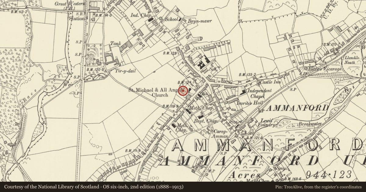
5 historical maps cover this location, the earliest the 1860 map "41. Caermathen." (David Rumsey Map Collection, Stanford Libraries).
Historical maps covering this location
- 1860 · 41. Caermathen. (David Rumsey Map Collection, Stanford Libraries)
- 1891 · Sheet 10. Ordnance Survey of England and Wales. . (David Rumsey Map Collection, Stanford Libraries)
- 1898 · 230 Ammanford (Hills) (David Rumsey Map Collection, Stanford Libraries)
- 1898 · 230 Ammanford (Outline) (David Rumsey Map Collection, Stanford Libraries)
- 1901 · Sheet 14. (David Rumsey Map Collection, Stanford Libraries)
Cadw's description
Location
Situated behind Miners Welfare Club and alongside churchyard.
History
Circa 1935 cinema by J Owen Parry of Ammanford, built for the Miners Welfare Club.
Exterior
Red brick with imitation-stone terracotta dressings and slate hipped roof with two ridge ventilators. Large scale, single-storey with SE end facade. Centre is projected with two outer panelled brick piers framing two fine fluted Corinthian columns in antis and centre long aedicule window with metal glazing bars. Window has moulded surround, pediment on consoles and moulded sill with flat surround slightly raised from brickwork. Broad two-step band beneath window over full width opening, now with altered doors but original outer pilasters. (Old photographs show a metal illuminated canopy). Finely detailed main entablature, the frieze with long outer panels and seven square centre panels, the outer ones with rosettes, the inner three recessed with small tilting lights. Big cornice and slightly ridged blocking course. Recessed behind is a hipped projection from roofslope.
Flanking the centre are plain long narrow lights over a pair of small blocked floor window, imitation stone plinth, raised red brick angle quoins, minimal brick frieze continuing line of lower part of main entablature and raised imitation-stone broad eaves band continuing line of cornice. No overhang to roof.
Side elevations: Very long with the plinth, brick frieze and eaves band continued around. Centre is recessed in one large area with imitation stone frieze of five sets of 1-3-1 recessed small square lights over the five large further-recessed panels, the outer ones with doorways in plain imitation stone surrounds and octagonal brick-framed ventilators over. Outermost bays have imitation-stone framed oval lights, above long openings, framed in imitation stone.
Interior
Inserted ceiling, deep balcony survives, and from balcony level some plasterwork to pilasters and broad bands to shallow-curved ceiling are visible. Also some plaster decoration remains in first floor foyer, pilasters and moulded arches.
Reason for designation
Included as a powerful example of inter-war architecture and as the most prominent memorial of the coal-mining history in the area.
Nearby in the register
- Lloyds Bank BuildingCommercialunder 1 mi
- The ArcadeCommercialunder 1 mi
- The ArcadeCommercialunder 1 mi
- The ArcadeCommercialunder 1 mi
Other entries of the same register within about three miles of this one, by straight line.