Cof Cymru: National Historic Assets of Wales · Wales
Outbuilding to rear of Plas Llangoedmor
Llangoedmor, Ceredigion, Wales
A Grade II listed building in Llangoedmor, Ceredigion, designated on 10 August 1994.
The record
- Designation
- Listed building, Grade II
- Broad class
- Domestic
- Date of designation
- 10 August 1994
- Locality
- Llangoedmor
- Community
- Llangoedmor
- Unitary authority
- Ceredigion
- Country
- Wales
- Coordinates
- 52.08260, -4.63269
- Cadw reference
- 14773
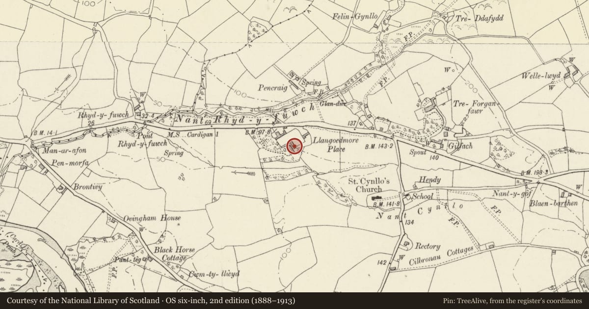
Slide toward Today to fade the historical sheet and see the modern map underneath.
David Rumsey Map Collection, Stanford LibrariesDavid Rumsey Map Collection, Stanford LibrariesDavid Rumsey Map Collection, Stanford LibrariesDavid Rumsey Map Collection, Stanford LibrariesDavid Rumsey Map Collection, Stanford Libraries
5 historical maps cover this location, the earliest the 1608 map "(13) Cambriae Typus." (David Rumsey Map Collection, Stanford Libraries).
Historical maps covering this location
- 1608 · (13) Cambriae Typus. (David Rumsey Map Collection, Stanford Libraries)
- 1637 · Particular description of Wales. Cambria seu Wallia (David Rumsey Map Collection, Stanford Libraries)
- 1830 · V.3:11-15:XV. Britisches Reich. A. Kon: England. b. Frstenthum Wales: Shire: 37-40 (David Rumsey Map Collection, Stanford Libraries)
- 1898 · 193 Cardigan (Hills) (David Rumsey Map Collection, Stanford Libraries)
- 1901 · Sheet 13. (David Rumsey Map Collection, Stanford Libraries)
Cadw's description
Location
Situated immediately behind E side of house.
Exterior
Earlier to mid C19 range of outbuildings, whitewashed rubble stone and imitation slate roofs, single storey and loft, L-plan. Cut-stone voussoirs to openings. At N end a short gabled return with broad arch in angle and 9-pane window to left. Main range faces W and has ground floor window, window, door, taller door with overlight, window, and door. Two first floor 6-pane casements with stone voussoir heads. One window in S end ground floor. Set back S end range with big stone outside steps across W front, with arch under giving access to ground floor store. First floor has window, door, and door onto outside-stair landing, the window with horizontally-sliding casements, and all with timber lintels. Brick S end stack.
Interior
N end room has big fireplace, recess for copper to one side and bread oven to other.
Reason for designation
Part of good group at Plas Llangoedmor.
Nearby in the register
- Privy at Plas LlangoedDomesticunder 1 mi
- Plas LlangoedmoreDomesticunder 1 mi
- Walled Garden at Plas LlangoedmorDomesticunder 1 mi
- Gatepiers and Flanking Railings to Driveway at Plas LlangoedmorDomesticunder 1 mi
Other entries of the same register within about three miles of this one, by straight line.