Cof Cymru: National Historic Assets of Wales · Wales
Midland Bank
Colwyn Bay, Conwy, Wales
A Grade II listed building in Colwyn Bay, Conwy, designated on 25 July 1994.
The record
- Designation
- Listed building, Grade II
- Broad class
- Commercial
- Date of designation
- 25 July 1994
- Locality
- Colwyn Bay
- Community
- Colwyn Bay
- Unitary authority
- Conwy
- Country
- Wales
- Coordinates
- 53.29515, -3.72804
- Cadw reference
- 14672
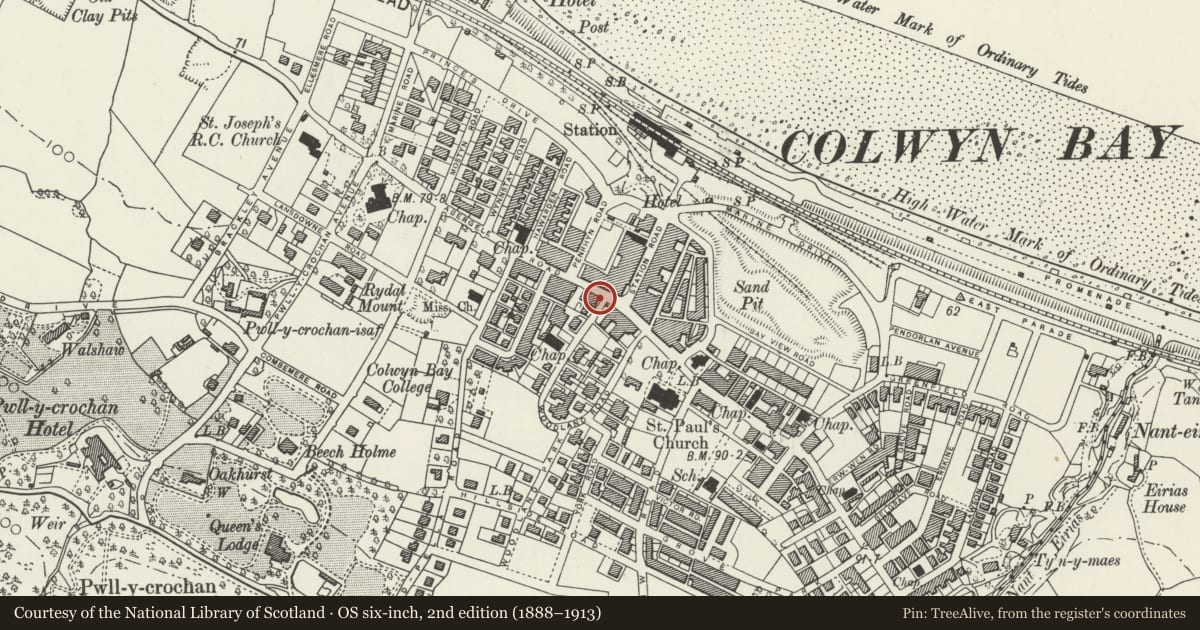
Slide toward Today to fade the historical sheet and see the modern map underneath.
David Rumsey Map Collection, Stanford LibrariesDavid Rumsey Map Collection, Stanford LibrariesNational Library of ScotlandDavid Rumsey Map Collection, Stanford LibrariesLlyfrgell Genedlaethol Cymru – The National Library of Wales
5 historical maps cover this location, the earliest the 1795 map "To Sir Watkin Williams-Wynn Bart ... the map of the six counties of North Wales is most humbly inscribed by his obedient humble servant" (Llyfrgell Genedlaethol Cymru – The National Library of Wales).
Historical maps covering this location
- 1795 · To Sir Watkin Williams-Wynn Bart ... the map of the six counties of North Wales is most… (Llyfrgell Genedlaethol Cymru – The National Library of Wales)
- 1883 · Watershed map England, Wales 3. (David Rumsey Map Collection, Stanford Libraries)
- 1898 · 95 Rhyl (Hills) (David Rumsey Map Collection, Stanford Libraries)
- 1900 · Denbighshire Sheet III.NE (National Library of Scotland)
- 1901 · Sheet 9 and 10. (David Rumsey Map Collection, Stanford Libraries)
Cadw's description
Location
On the W corner with Woodland Road West.
History
Originally the N and S Wales Bank Ltd, the bank is the work of Wolfall and Eccles, architects, 1903-4, remodelling an earlier building which formed part of a terrace of c1880.
Exterior
White ashlar with hipped slate roof with axial stacks. 2 storeys, 4- window range to Conway Road, and 3- window return to Woodland Road West. On the Conway Road elevation, there are 5 windows to the banking hall, which is articulated by corbelled pilasters and triglyph frieze. 2-window return to Woodland Road West, the left hand window in advanced rectangular bay. Upper windows have brackets to entablature hoods, and in the Conway Road elevation, are paired to either side of a raised panel which is lettered with the banks original name. Entrance to right of return elevation, in projecting porch surmounted by a steep pediment; moulded round-arched doorway with heavy arched doorway with heavy scrolled bracket to arch, and fluid low reliefs in the spandrels. Balustraded parapet above heavy projecting eaves cornice. Beyond the main building in Woodland Road West, 2 further blocks are recessed slightly from the
main building line. These have 2-pane sash windows in moulded architraves to
first floor, and wide windows to ground floor. Pediment with triglyph frieze over the left hand window of the ground floor. Cornice and blocking course.
Interior
Ornate ceiling to banking hall, deeply coved, and divided by heavy ribs with low relief foliate swags. Shields of arms etc. in relief in wall panels.
Reason for designation
A good example of a small-scale bank building which uses a distinctive architectural vocabulary to emphasise its commercial purpose, and which retains a fine banking hall.
Nearby in the register
- The Central Public HouseCommercialunder 1 mi
- Queens Buildings and Liberites Bar (No. 1 of 9 buildings )Commercialunder 1 mi
- Queens Buildings and Liberties Bar (No. 2 of 9 buildings)Commercialunder 1 mi
- Queens Buildings and Liberties Bar (No. 3 of 9 buildings )Commercialunder 1 mi
Other entries of the same register within about three miles of this one, by straight line.