Cof Cymru: National Historic Assets of Wales · Wales
4 Ael-y-Bryn Road
Colwyn Bay, Conwy, Wales
A Grade II listed building in Colwyn Bay, Conwy, designated on 25 July 1994.
The record
- Designation
- Listed building, Grade II
- Broad class
- Domestic
- Date of designation
- 25 July 1994
- Locality
- Colwyn Bay
- Community
- Colwyn Bay
- Unitary authority
- Conwy
- Country
- Wales
- Coordinates
- 53.29125, -3.73097
- Cadw reference
- 14667
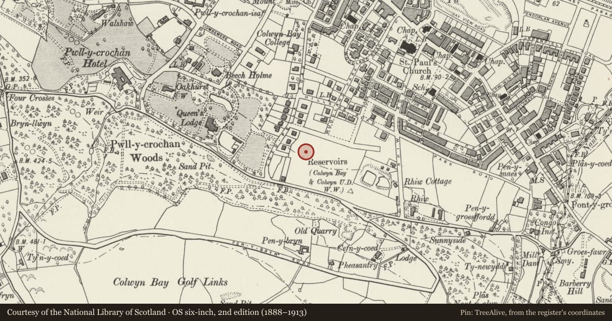
Slide toward Today to fade the historical sheet and see the modern map underneath.
David Rumsey Map Collection, Stanford LibrariesDavid Rumsey Map Collection, Stanford LibrariesNational Library of ScotlandDavid Rumsey Map Collection, Stanford LibrariesLlyfrgell Genedlaethol Cymru – The National Library of Wales
5 historical maps cover this location, the earliest the 1795 map "To Sir Watkin Williams-Wynn Bart ... the map of the six counties of North Wales is most humbly inscribed by his obedient humble servant" (Llyfrgell Genedlaethol Cymru – The National Library of Wales).
Historical maps covering this location
- 1795 · To Sir Watkin Williams-Wynn Bart ... the map of the six counties of North Wales is most… (Llyfrgell Genedlaethol Cymru – The National Library of Wales)
- 1883 · Watershed map England, Wales 3. (David Rumsey Map Collection, Stanford Libraries)
- 1898 · 95 Rhyl (Hills) (David Rumsey Map Collection, Stanford Libraries)
- 1900 · Denbighshire Sheet III.NE (National Library of Scotland)
- 1901 · Sheet 9 and 10. (David Rumsey Map Collection, Stanford Libraries)
Cadw's description
Location
Below the level of the Road, one of a reverse-pair with No.6.
History
Built c1930.
Exterior
Roughcast render, plain tiled roof with axial and end wall stacks. Simple Arts and Crafts style, and probably the work of North and Padmore, architects, of Llanfairfechan. 2 storeys, with stepped asymmetrical gables facing the street. The central gable houses porch and staircase, the roof dipped down to the right to form the porch, which has shouldered archway aligned with the inner doorway. Narrow stair window at centre of gable. Wider gable slightly set back to the left houses the principal living room, and has 3-light, metal-framed, casement window on each floor. Narrower bay to right of entrance has similar 2-light casement window on each floor, the upper window in a catslide dormer which breaks the eaves line. Roofs throughout are carried forward on bold plain brackets, and there are slight, swept hood moulds over all windows.
Reason for designation
Included as a very good example of a small house of c1930, in the Arts and Crafts idiom which has especially associated with the progressive architecture and planning of the garden village movement. Forms a group with No.6.
Nearby in the register
- 6 Ael-y-Bryn RoadDomesticunder 1 mi
- Tudor LodgeDomesticunder 1 mi
- 16 Coed Pella RoadDomesticunder 1 mi
- BrendonDomesticunder 1 mi
Other entries of the same register within about three miles of this one, by straight line.