Cof Cymru: National Historic Assets of Wales · Wales
Cowhouse at Maes-gwyn
Pentrefoelas, Conwy, Wales
A Grade II listed building in Maes-gwyn, Pentrefoelas, Conwy, designated on 23 June 1967.
The record
- Designation
- Listed building, Grade II
- Broad class
- Agriculture and Subsistence
- Date of designation
- 23 June 1967
- Locality
- Maes-gwyn
- Town
- Pentrefoelas
- Community
- Pentrefoelas
- Unitary authority
- Conwy
- Country
- Wales
- Coordinates
- 53.05744, -3.69738
- Cadw reference
- 14651
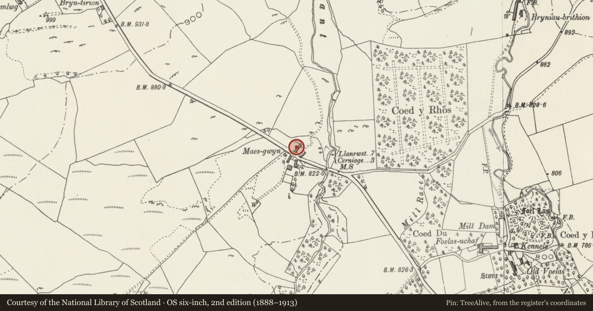
Slide toward Today to fade the historical sheet and see the modern map underneath.
David Rumsey Map Collection, Stanford LibrariesDavid Rumsey Map Collection, Stanford LibrariesLlyfrgell Genedlaethol Cymru – The National Library of WalesDavid Rumsey Map Collection, Stanford LibrariesDavid Rumsey Map Collection, Stanford Libraries
5 historical maps cover this location, the earliest the 1795 map "To Sir Watkin Williams-Wynn Bart ... the map of the six counties of North Wales is most humbly inscribed by his obedient humble servant" (Llyfrgell Genedlaethol Cymru – The National Library of Wales).
Historical maps covering this location
- 1795 · To Sir Watkin Williams-Wynn Bart ... the map of the six counties of North Wales is most… (Llyfrgell Genedlaethol Cymru – The National Library of Wales)
- 1830 · V.3:11-15:XV. Britisches Reich. A. Kon: England. b. Frstenthum Wales: Shire: 37-40 (David Rumsey Map Collection, Stanford Libraries)
- 1883 · Watershed map England, Wales 3. (David Rumsey Map Collection, Stanford Libraries)
- 1898 · 120 Corwen (Hills) (David Rumsey Map Collection, Stanford Libraries)
- 1901 · Sheet 9 and 10. (David Rumsey Map Collection, Stanford Libraries)
Cadw's description
Location
The main cowhouse is the more westerly of two parallel farm ranges at right angles to the road, opposite Maes-gwyn.
History
Probably C18 or early C19.
Exterior
Built of rubble stonework with a slate roof. Cowhouse of 7 bays, extended at the E end by a further building with a higher roof, and again by a lower 3-bay open fronted animal shelter with a stone-walled enclosure in front, which encloses the farmyard to the E. A narrower wing of 2 bays runs E against the road. Both sides of the building are largely obscured by modern farm buildings. The road elevation has one vented window and a pitching door in the gable of the main range.
Reason for designation
Included as part of the fine farm group, associated with the listed C17 farmhouse at Maes-gwyn.
Nearby in the register
- Cowhouse and carthouse at Maes-gwynDomesticunder 1 mi
- Farm building at Maes-gwynDomesticunder 1 mi
- Outbuilding at Maes-gwynDomesticunder 1 mi
- Maes-gwynDomesticunder 1 mi
Other entries of the same register within about three miles of this one, by straight line.