Cof Cymru: National Historic Assets of Wales · Wales
Belgrave Gardens
Uplands, Swansea, Wales
A Grade II listed building in Uplands, Swansea, designated on 25 July 1994.
The record
- Designation
- Listed building, Grade II
- Broad class
- Domestic
- Date of designation
- 25 July 1994
- Community
- Uplands
- Unitary authority
- Swansea
- Country
- Wales
- Coordinates
- 51.61871, -3.96291
- Cadw reference
- 14633
Slide toward Today to fade the historical sheet and see the modern map underneath.
David Rumsey Map Collection, Stanford LibrariesDavid Rumsey Map Collection, Stanford LibrariesDavid Rumsey Map Collection, Stanford LibrariesDavid Rumsey Map Collection, Stanford LibrariesDavid Rumsey Map Collection, Stanford Libraries
5 historical maps cover this location, the earliest the 1636 map "Cornubia : Devonia, Somersetus, Dorcestria, Wiltonia, Glocestria ..." (David Rumsey Map Collection, Stanford Libraries).
Historical maps covering this location
- 1636 · Cornubia : Devonia, Somersetus, Dorcestria, Wiltonia, Glocestria ... (David Rumsey Map Collection, Stanford Libraries)
- 1637 · The fourth table of England. Cornub. Devonia, Somerset etc. (David Rumsey Map Collection, Stanford Libraries)
- 1865 · England and Wales. England No. 6. (David Rumsey Map Collection, Stanford Libraries)
- 1891 · Sheet 10. Ordnance Survey of England and Wales. . (David Rumsey Map Collection, Stanford Libraries)
- 1897 · 247 Swansea (Hills) (David Rumsey Map Collection, Stanford Libraries)
Cadw's description
Location
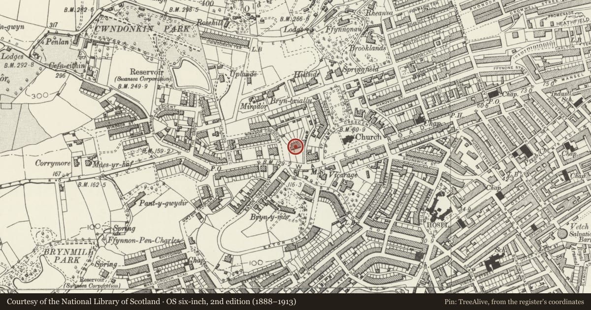
Between Mirador Crescent and Belgrave Lane; set back behind gardens.
History
Houses of circa 1860; No 1 slightly later addition. Not on tithe map (1843); on 1st Ed 25" OS map (surveyed 1878) as Belgrave Terrace.
Exterior
Two storey terrace of 8 houses, Nos 2-8 stucco, articulated by pilaster strips; No 1 is later addition in exposed grey-brown stone with bathstone dressings. Slate roofs but modern tiles to Nos 2 and 7; flat roofed dormers to Nos 3, 4, 5 and 8. Parapet, pierced to form balustrade over entrances; bracketed cornice. Rectangular yellow brick chimneys. Nos 2-7 comprise three 4-window mirrored pairs; doors grouped to centres which are slightly recessed. On first floors, narrow sash windows to centre, broader sash windows (marginal glazing to Nos 4-7) to L and R.
Doors (mainly original panelled doors with inserted glazing) with rectangular overlights, set back in recessed porch with dentil cornice and columns. To each side of doors flat-roofed splayed bay. No 8 is larger double-fronted house in same style but with modern glazing. No 1 (in stone) has on first floor, tripartite hornless sash window to L and hornless sash window to R. On ground floor, entrance doorway to R has pedimented stone doorcase, rectangular overlight, splayed bay to L. To R, to Belgrave Lane, large 12-pane hornless sash window; 2 small windows at eaves, 16-pane hornless sash window to first and ground floors, doorway to end in extension with monopitch roof.
Reason for designation
Included despite some alterations as good group of mid C19 terraced houses.
Nearby in the register
- Belgrave GardensDomesticunder 1 mi
- Belgrave GardensDomesticunder 1 mi
- Belgrave GardensDomesticunder 1 mi
- Belgrave GardensDomesticunder 1 mi
Other entries of the same register within about three miles of this one, by straight line.