Cof Cymru: National Historic Assets of Wales · Wales
Gwalia
Overton, Wrexham, Wales
A Grade II listed building in Knolton, Overton, Wrexham, designated on 15 March 1994.
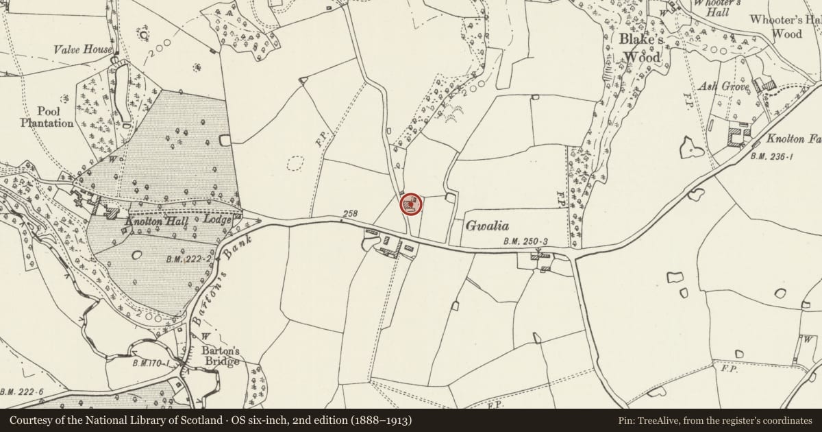
The record
- Designation
- Listed building, Grade II
- Broad class
- Domestic
- Date of designation
- 15 March 1994
- Locality
- Knolton
- Community
- Overton
- Unitary authority
- Wrexham
- Country
- Wales
- Coordinates
- 52.95879, -2.95584
- Cadw reference
- 14474
Slide toward Today to fade the historical sheet and see the modern map underneath.
David Rumsey Map Collection, Stanford LibrariesDavid Rumsey Map Collection, Stanford LibrariesDavid Rumsey Map Collection, Stanford LibrariesDavid Rumsey Map Collection, Stanford LibrariesDavid Rumsey Map Collection, Stanford Libraries
5 historical maps cover this location, the earliest the 1608 map "(13) Cambriae Typus." (David Rumsey Map Collection, Stanford Libraries).
Historical maps covering this location
- 1608 · (13) Cambriae Typus. (David Rumsey Map Collection, Stanford Libraries)
- 1637 · Particular description of Wales. Cambria seu Wallia (David Rumsey Map Collection, Stanford Libraries)
- 1883 · Watershed map England, Wales 3. (David Rumsey Map Collection, Stanford Libraries)
- 1898 · 121 Wrexham (Hills) (David Rumsey Map Collection, Stanford Libraries)
- 1901 · Sheet 9 and 10. (David Rumsey Map Collection, Stanford Libraries)
Cadw's description
Location
Set back from the road west of Gwalia Farm, alongside the track leading to Llan-y-Cefn.
History
House, originally a farmhouse (the remains of its farm-buildings survive south of the road). Mid C18, with early C19 modifications.
Exterior
Brick with slate roof. 2 storeys, 3 window range with central entrance; 6-panelled door beneath hood. Flanking window are paired 2-pane sashes with margin lights, inserted, probably in the early C19. Upper windows are also 2-pane sashes with margins lights, inserted in original openings. Coved plaster eaves cornice. Rear elevation retains remains of 3 original wood mullioned and transomed windows, in wide openings with cambered brick heads. All are wholly or partially blocked, and one is cut by the rear wing, which appear to have been added in the early C19. End wall stacks.
Reason for designation
A good example of a mid C18 farmhouse, of a kind typical of this area.
Nearby in the register
- Gwalia FarmhouseDomesticunder 1 mi
- Byre/Stable Range at Gwalia FarmDomesticunder 1 mi
- Farm-Buildings and Icehouse at Llan-y-CefnDomesticunder 1 mi
- Llan-y-CefnDomesticunder 1 mi
Other entries of the same register within about three miles of this one, by straight line.