Cof Cymru: National Historic Assets of Wales · Wales
17 Salop Road
Overton, Wrexham, Wales
A Grade II listed building in Overton, Wrexham, designated on 15 March 1994.
The record
- Designation
- Listed building, Grade II
- Broad class
- Domestic
- Date of designation
- 15 March 1994
- Community
- Overton
- Unitary authority
- Wrexham
- Country
- Wales
- Coordinates
- 52.96695, -2.93464
- Cadw reference
- 14455
Slide toward Today to fade the historical sheet and see the modern map underneath.
David Rumsey Map Collection, Stanford LibrariesDavid Rumsey Map Collection, Stanford LibrariesDavid Rumsey Map Collection, Stanford LibrariesDavid Rumsey Map Collection, Stanford LibrariesDavid Rumsey Map Collection, Stanford Libraries
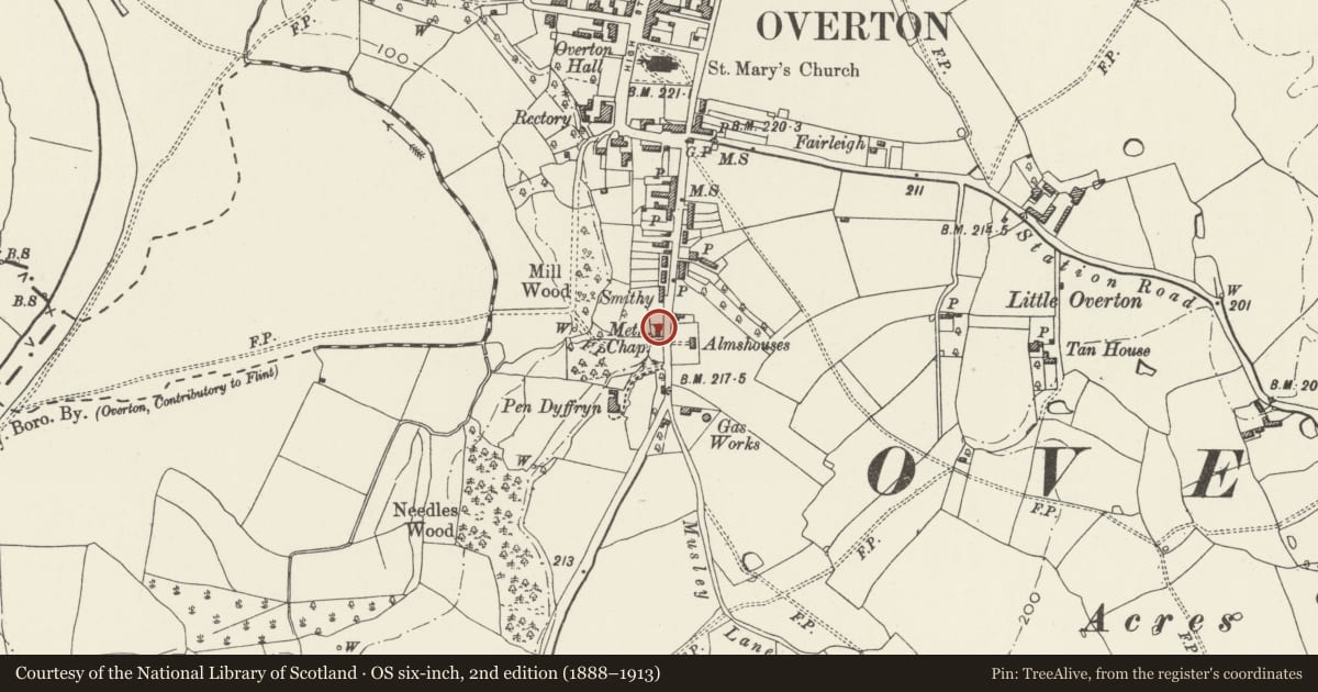
5 historical maps cover this location, the earliest the 1608 map "(13) Cambriae Typus." (David Rumsey Map Collection, Stanford Libraries).
Historical maps covering this location
- 1608 · (13) Cambriae Typus. (David Rumsey Map Collection, Stanford Libraries)
- 1637 · Particular description of Wales. Cambria seu Wallia (David Rumsey Map Collection, Stanford Libraries)
- 1830 · V.3:11-15:XV.Britisches Reich. A. Kon: England. a. England ab sich: Shire:15-17, 33 (David Rumsey Map Collection, Stanford Libraries)
- 1883 · Watershed map England, Wales 3. (David Rumsey Map Collection, Stanford Libraries)
- 1901 · Sheet 9 and 10. (David Rumsey Map Collection, Stanford Libraries)
Cadw's description
Location
On the edge of the village, set back from the road in narrow gardens.
History
Originally built as a chapel in 1816 - recorded as chapel and cottage (perhaps the minister’s dwelling) in the Tithe survey of 1838, and converted into a row of 3 cottages in the later C19.
Exterior
Flemish bond brickwork with slate roof. 2 storeys, 3 window range, comprising 3 single unit, double pile planned dwellings. The row is asymmetrically arranged, with paired doorways (inserted on conversion) to Nos 16 and 17, flanked by a single window each side; No 18 has entrance to right (probably original) with window adjoining to the left. Upper windows align with those below, and all openings have round arched brick heads. No 18 has sash windows with radial glazing, which may be original; Nos 16 and 17 have casement windows with transoms. Boarded doors (renewed in No 16) with plain fanlights, and oculi in upper storey over the outermost entrances, with datestone in that to right. End and axial stacks.
The front gardens are bounded by cast iron spear head railings on chamfered stone plinth wall, incorporating 3 gates.
Reason for designation
Edward Hubbard, Clwyd, Buildings of Wales series, 1986, p.412;
Tithe Map of the Parish of Overton, 1838 (Clwyd County Record Office).
Nearby in the register
- 16 Salop RoadDomesticunder 1 mi
- 18 Salop RoadDomesticunder 1 mi
- Railings and Gates (to 16, 17 & 18)Domesticunder 1 mi
- Candlewick CottageDomesticunder 1 mi
Other entries of the same register within about three miles of this one, by straight line.