Cof Cymru: National Historic Assets of Wales · Wales
Premises attached to South
Pembroke Dock, Pembrokeshire, Wales
A Grade II listed building in Pembroke Dock, Pembrokeshire, designated on 18 February 1994.
The record
- Designation
- Listed building, Grade II
- Broad class
- Commercial
- Date of designation
- 18 February 1994
- Community
- Pembroke Dock
- Unitary authority
- Pembrokeshire
- Country
- Wales
- Coordinates
- 51.69916, -4.94264
- Cadw reference
- 14422
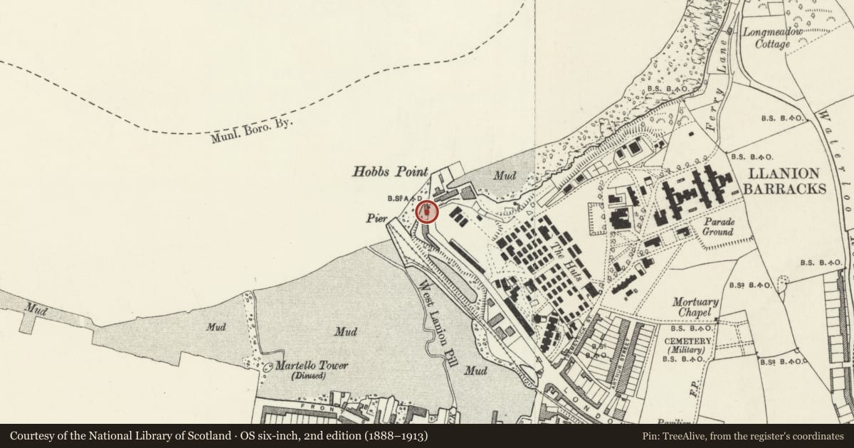
Slide toward Today to fade the historical sheet and see the modern map underneath.
David Rumsey Map Collection, Stanford LibrariesDavid Rumsey Map Collection, Stanford LibrariesDavid Rumsey Map Collection, Stanford LibrariesDavid Rumsey Map Collection, Stanford LibrariesDavid Rumsey Map Collection, Stanford Libraries
5 historical maps cover this location, the earliest the 1636 map "Cornubia : Devonia, Somersetus, Dorcestria, Wiltonia, Glocestria ..." (David Rumsey Map Collection, Stanford Libraries).
Historical maps covering this location
- 1636 · Cornubia : Devonia, Somersetus, Dorcestria, Wiltonia, Glocestria ... (David Rumsey Map Collection, Stanford Libraries)
- 1865 · England and Wales. England No. 6. (David Rumsey Map Collection, Stanford Libraries)
- 1891 · Sheet 10. Ordnance Survey of England and Wales. . (David Rumsey Map Collection, Stanford Libraries)
- 1898 · 228 Haverfordwest (Hills) (David Rumsey Map Collection, Stanford Libraries)
- 1901 · Sheet 13. (David Rumsey Map Collection, Stanford Libraries)
Cadw's description
Location
Situated on W side of Hobbs Point, backing on to the sea.
History
Possibly built in association with the Irish Mail service from Hobbs Point opened 1834, at which time offices and storehouses were said to have been built. By the later C19 used by Royal Engineers in association with Pier House. Marked as Military Stores Depot on 1860s map (copy in RCAHM Aberystwyth).
Exterior
Early to mid C19 warehouse, now club and house. Stucco with hipped roof and rendered ridge stack to house. Two-storey seven-window range, originally of 16-pane sashes above, with centre broad arched loading door to first floor and similar ground-floor entry. First-floor door has been infilled and part-replaced by matching sash, ground floor opening is infilled with C20 glazing and door. Ground floor left has C20 horizontal window and door. Ground floor right has C20 horizontal window, door to Old Pier House, circular window and small door. 16-pane sash on N end wall. Rear wall has some 12 and 16-pane sashes.
Reason for designation
Group value with other listed items at Hobbs Point.
Nearby in the register
- Old Pier HouseDomesticunder 1 mi
- Telephone Call-box at Hobbs PointCommunicationsunder 1 mi
- Pier HouseCommercialunder 1 mi
- Hobbs PointDefenceunder 1 mi
Other entries of the same register within about three miles of this one, by straight line.