Cof Cymru: National Historic Assets of Wales · Wales
Abernant including Front Garden Railings and Gate
Brawdy, Pembrokeshire, Wales
A Grade II listed building in Abernant, Llandeloy, Brawdy, Pembrokeshire, designated on 15 February 1994.
The record
- Designation
- Listed building, Grade II
- Broad class
- Domestic
- Date of designation
- 15 February 1994
- Locality
- Abernant
- Town
- Llandeloy
- Community
- Brawdy
- Unitary authority
- Pembrokeshire
- Country
- Wales
- Coordinates
- 51.90957, -5.15096
- Cadw reference
- 14398
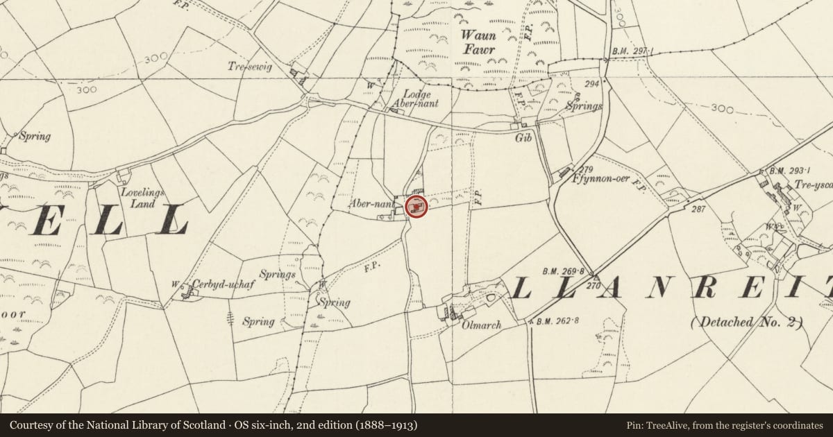
Slide toward Today to fade the historical sheet and see the modern map underneath.
David Rumsey Map Collection, Stanford LibrariesDavid Rumsey Map Collection, Stanford LibrariesDavid Rumsey Map Collection, Stanford LibrariesDavid Rumsey Map Collection, Stanford LibrariesDavid Rumsey Map Collection, Stanford Libraries
5 historical maps cover this location, the earliest the 1608 map "(13) Cambriae Typus." (David Rumsey Map Collection, Stanford Libraries).
Historical maps covering this location
- 1608 · (13) Cambriae Typus. (David Rumsey Map Collection, Stanford Libraries)
- 1636 · Cornubia : Devonia, Somersetus, Dorcestria, Wiltonia, Glocestria ... (David Rumsey Map Collection, Stanford Libraries)
- 1637 · Particular description of Wales. Cambria seu Wallia (David Rumsey Map Collection, Stanford Libraries)
- 1898 · 209 St David's (Hills) (David Rumsey Map Collection, Stanford Libraries)
- 1901 · Sheet 13. (David Rumsey Map Collection, Stanford Libraries)
Cadw's description
Location
Situated some 1.5km W of Treffynnon.
Exterior
Mid to later C19 farmhouse in coursed rubble stone with imitation slate close-eaved roof and stone end stacks. Two-storey three-window front of large 12-pane sashes with stone voussoirs and keystones to cambered heads, and slate sills. Glazing bars are set to give narrower marginal panes. Centre door with overlight and similar stone voussoirs. C20 glazed timber porch. Large NE rear range with three similar sashes above, one to ground floor left, centre C20 addition and two 4-pane sashes to right. E end stone stack.
Front garden has iron railings on dwarf coped wall, spearhead rails with dog bars, two centre stone piers and pedestrian gate. Stone end piers. Rubble stone N side wall back to the house.
Reason for designation
An unusually large and unaltered C19 farmhouse, of group value with coach-house.
Nearby in the register
- Coach-House at AbernantDomesticunder 1 mi
- Felin WenIndustrialunder 1 mi
- White House Burial ChamberChambered Tombunder 1 mi
- L-Plan Range of Outbuildings at Cerbyd Old FarmhouseAgriculture and Subsistenceunder 1 mi
Other entries of the same register within about three miles of this one, by straight line.