Cof Cymru: National Historic Assets of Wales · Wales
14A Water Street
Rhyl, Denbighshire, Wales
A Grade II listed building in Rhyl, Denbighshire, designated on 14 February 1994.
The record
- Designation
- Listed building, Grade II
- Broad class
- Commercial
- Date of designation
- 14 February 1994
- Community
- Rhyl
- Unitary authority
- Denbighshire
- Country
- Wales
- Coordinates
- 53.31983, -3.49261
- Cadw reference
- 14318
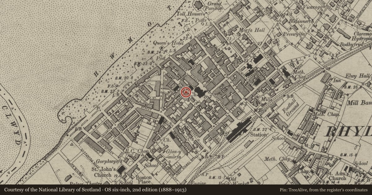
Slide toward Today to fade the historical sheet and see the modern map underneath.
David Rumsey Map Collection, Stanford LibrariesDavid Rumsey Map Collection, Stanford LibrariesNational Library of ScotlandDavid Rumsey Map Collection, Stanford LibrariesNational Library of Scotland
5 historical maps cover this location, the earliest the 1883 map "Watershed map England, Wales 3." (David Rumsey Map Collection, Stanford Libraries).
Historical maps covering this location
- 1883 · Watershed map England, Wales 3. (David Rumsey Map Collection, Stanford Libraries)
- 1898 · 95 Rhyl (Hills) (David Rumsey Map Collection, Stanford Libraries)
- 1901 · Sheet 9 and 10. (David Rumsey Map Collection, Stanford Libraries)
- 1930 · OS Popular Edition 1919-1947 (National Library of Scotland)
- 1963 · Map No. 36 - Local Government Commission for Wales : [Definitive maps showing proposed… (National Library of Scotland)
Cadw's description
Location
On the S corner with Bideford Street.
History
Probably one of the earliest building to survive in this part of the town centre, and dating the first phase of Rhyl's development as a town, between c1836 and c1850. Originally built as a house, but converted to shops during the later C19 (c1870).
Exterior
Rendered, with slate roof, coped gables and end wall and axial stacks, 3 window range to Water Street, with 3 window lower wing to Bedford Street. Shop front advanced from ground floor, with the fascia carried onfluted cast iron columns either side of central paired doorways, supported canted oriel sash windows above the entrance. Shop windows form rectangular bays to either side of doorways, and the left hand window retain early C20 leaded upper lights. Smaller windows to right hand unit, which has corner entrance. 12-pane sash windows to either side of central oriel window above, in shaped plaster architraves. Corner entrance to right hand shop. Fascia articulated bu heavy fluted console brackets, continues across gable and rear wing on Bedford Street elevation, over a further shop front in similar style. 12-pane sash windows above, and blind central window.
Reason for designation
A rare example of an early C19 building from the earliest phase of Rhyl's urban development, which hasspecial charater from its later C19 use as a shop.
Nearby in the register
- 16 Water StreetCommercialunder 1 mi
- 14 Water StreetCommercialunder 1 mi
- Christchurch United Reformed ChurchReligious, Ritual and Funeraryunder 1 mi
- Town HallCivilunder 1 mi
Other entries of the same register within about three miles of this one, by straight line.