Cof Cymru: National Historic Assets of Wales · Wales
Pengwern Uchaf
Cenarth, Carmarthenshire, Wales
A Grade II listed building in Penrherber, Cenarth, Carmarthenshire, designated on 2 March 1994.
The record
- Designation
- Listed building, Grade II
- Broad class
- Domestic
- Date of designation
- 2 March 1994
- Locality
- Penrherber
- Community
- Cenarth
- Unitary authority
- Carmarthenshire
- Country
- Wales
- Coordinates
- 52.02690, -4.50995
- Cadw reference
- 14249
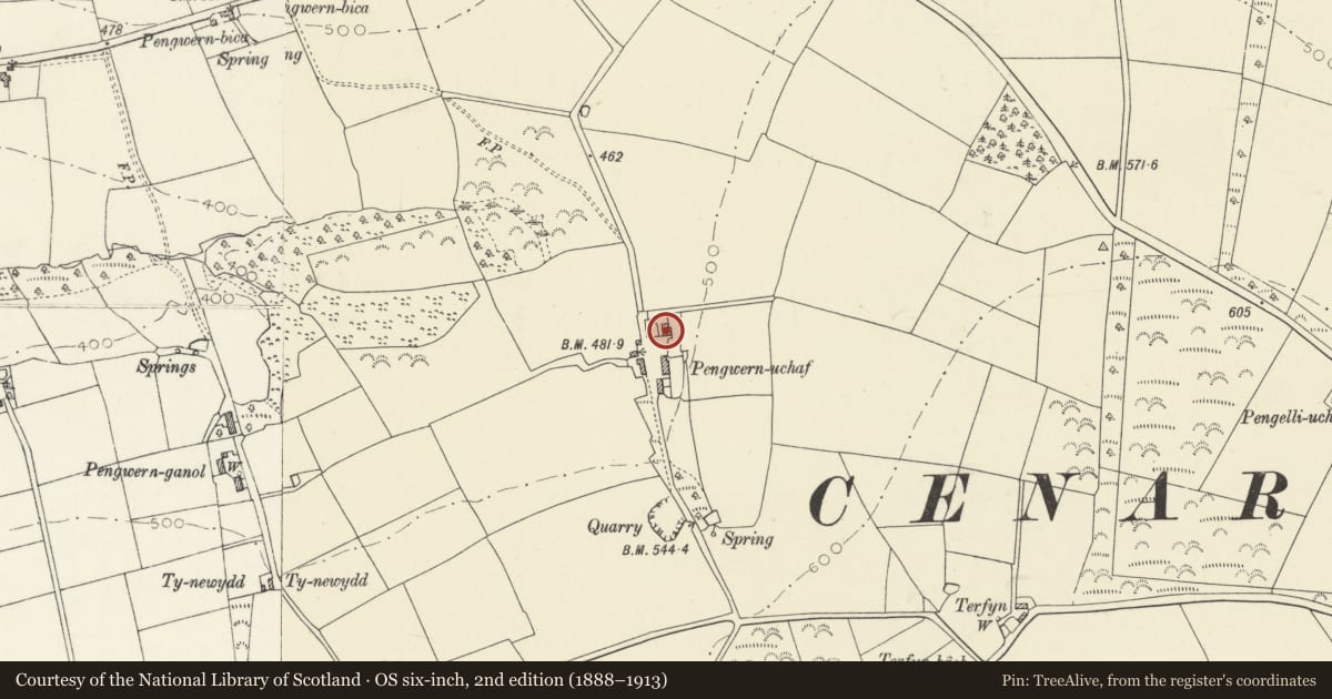
Slide toward Today to fade the historical sheet and see the modern map underneath.
David Rumsey Map Collection, Stanford LibrariesDavid Rumsey Map Collection, Stanford LibrariesDavid Rumsey Map Collection, Stanford LibrariesDavid Rumsey Map Collection, Stanford LibrariesDavid Rumsey Map Collection, Stanford Libraries
5 historical maps cover this location, the earliest the 1830 map "V.3:11-15:XV. Britisches Reich. A. Kon: England. b. Frstenthum Wales: Shire: 37-40" (David Rumsey Map Collection, Stanford Libraries).
Historical maps covering this location
- 1830 · V.3:11-15:XV. Britisches Reich. A. Kon: England. b. Frstenthum Wales: Shire: 37-40 (David Rumsey Map Collection, Stanford Libraries)
- 1860 · 41. Caermathen. (David Rumsey Map Collection, Stanford Libraries)
- 1891 · Sheet 10. Ordnance Survey of England and Wales. . (David Rumsey Map Collection, Stanford Libraries)
- 1898 · 211 Newcastle Emlyn (Hills) (David Rumsey Map Collection, Stanford Libraries)
- 1901 · Sheet 14. (David Rumsey Map Collection, Stanford Libraries)
Cadw's description
Location
Situated some 1.2km WNW of Penrherber.
History
Dated 1756, but remodelled in earlier C19.
Exterior
Large farmhouse, colourwashed rubble stone with slate roof and late C19 brick end stacks. Two storeys, five bays, irregular spacing, the first with 16-pane hornless sash each floor, the second with C19 gabled timber porch, door and overlight, the third with 12-pane sash below, the windowhead cambered, and 16-pane hornless sash above, the fourth with 16-pane hornless sash below and 4-pane sash above (probably originally 16-pane). The end bay has a small late C19 4-pane sash in the fire-window position and the dateplaque 'RM 1756' in the upper angle. Windows have painted slate sills, upper windowheads are under eaves, lower windowheads are rendered. Rear roof is outshut with renewed eaves boards. S end wall has cambered-headed door and three 4-pane sashes.
Reason for designation
One of the few houses dated to the C18 in the area. The 16-pane sashes would appear to be of the earlier C19, and the chimneys and four-pane sashes of the late C19 or early C20. Marked on the 1839 Tithe Map as owned by John Colby, occupied by James Evans.
Nearby in the register
- Lofted Cartshed at Pengwarn UchafDomesticunder 1 mi
- Telephone Call-box at road junctionCommunicationsunder 1 mi
- LLainrhydwenDomestic1 mi
- The Old VicarageDomestic1 mi
Other entries of the same register within about three miles of this one, by straight line.