Cof Cymru: National Historic Assets of Wales · Wales
The Three Horseshoes Inn
Cenarth, Carmarthenshire, Wales
A Grade II listed building in Cenarth, Carmarthenshire, designated on 2 March 1994.
The record
- Designation
- Listed building, Grade II
- Broad class
- Commercial
- Date of designation
- 2 March 1994
- Community
- Cenarth
- Unitary authority
- Carmarthenshire
- Country
- Wales
- Coordinates
- 52.04497, -4.52418
- Cadw reference
- 14224
Slide toward Today to fade the historical sheet and see the modern map underneath.
David Rumsey Map Collection, Stanford LibrariesDavid Rumsey Map Collection, Stanford LibrariesDavid Rumsey Map Collection, Stanford LibrariesDavid Rumsey Map Collection, Stanford LibrariesDavid Rumsey Map Collection, Stanford Libraries
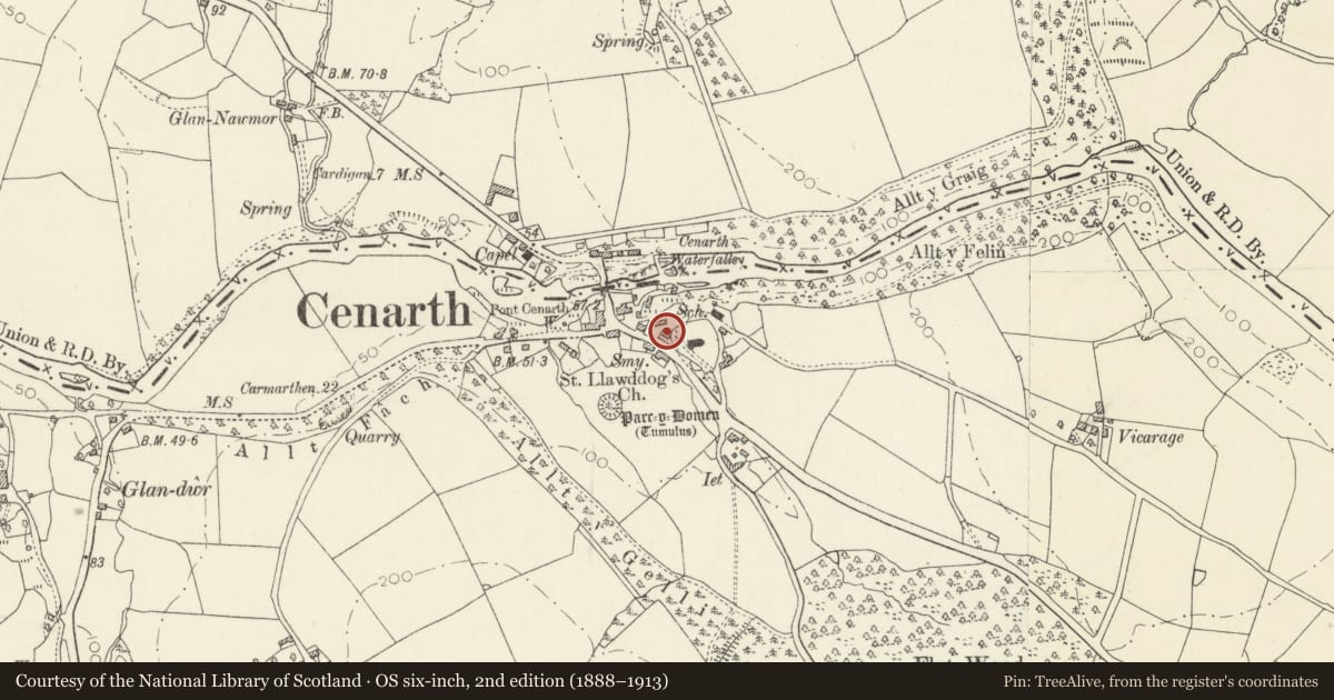
5 historical maps cover this location, the earliest the 1830 map "V.3:11-15:XV. Britisches Reich. A. Kon: England. b. Frstenthum Wales: Shire: 37-40" (David Rumsey Map Collection, Stanford Libraries).
Historical maps covering this location
- 1830 · V.3:11-15:XV. Britisches Reich. A. Kon: England. b. Frstenthum Wales: Shire: 37-40 (David Rumsey Map Collection, Stanford Libraries)
- 1860 · 41. Caermathen. (David Rumsey Map Collection, Stanford Libraries)
- 1891 · Sheet 10. Ordnance Survey of England and Wales. . (David Rumsey Map Collection, Stanford Libraries)
- 1899 · 194 Llangranog (Hills) (David Rumsey Map Collection, Stanford Libraries)
- 1901 · Sheet 14. (David Rumsey Map Collection, Stanford Libraries)
Cadw's description
Location
Situated on the main road, W of the church.
History
The inn was a stop for mail coaches from Carmarthen to Cardigan in the C19. Run by the Thomas family, innkeepers and blacksmiths. The Old Brewhouse, adjoining, may have been an earlier inn.
Exterior
Early to mid C19 inn, said to date from 1806 but exterior looks later, rendered with slate roof and two brick end stacks. Two storeys, three-window range of small arched sashes with radiating glazing bars in heads and slate sills. Centre C20 door in hipped C19 timber porch with slate roof. Single storey E end outbuilding with slate roof and stable door. Door has ventilation slots in upper half. Rear was outshut, but has large C20 rear additions.
Interior
Interior has large timber lintel to W end fireplace.
Reason for designation
Included for group value.
Nearby in the register
- The Old BrewhouseCommercialunder 1 mi
- Gateway to ChurchyardReligious, Ritual and Funeraryunder 1 mi
- PenybancDomesticunder 1 mi
- Smithy CottageEducationunder 1 mi
Other entries of the same register within about three miles of this one, by straight line.