Cof Cymru: National Historic Assets of Wales · Wales
White Rock
Carreghofa, Powys, Wales
A Grade II listed building in Carreghofa, Powys, designated on 5 April 1993.
The record
- Designation
- Listed building, Grade II
- Broad class
- Domestic
- Date of designation
- 5 April 1993
- Community
- Carreghofa
- Unitary authority
- Powys
- Country
- Wales
- Coordinates
- 52.78404, -3.09723
- Cadw reference
- 14208
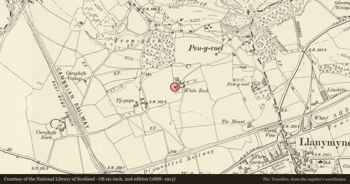
Slide toward Today to fade the historical sheet and see the modern map underneath.
David Rumsey Map Collection, Stanford LibrariesDavid Rumsey Map Collection, Stanford LibrariesDavid Rumsey Map Collection, Stanford LibrariesDavid Rumsey Map Collection, Stanford LibrariesLlyfrgell Genedlaethol Cymru – The National Library of Wales
5 historical maps cover this location, the earliest the 1795 map "To Sir Watkin Williams-Wynn Bart ... the map of the six counties of North Wales is most humbly inscribed by his obedient humble servant" (Llyfrgell Genedlaethol Cymru – The National Library of Wales).
Historical maps covering this location
- 1795 · To Sir Watkin Williams-Wynn Bart ... the map of the six counties of North Wales is most… (Llyfrgell Genedlaethol Cymru – The National Library of Wales)
- 1883 · Watershed map England, Wales 3. (David Rumsey Map Collection, Stanford Libraries)
- 1897 · 137 Oswestry (Hills) (David Rumsey Map Collection, Stanford Libraries)
- 1901 · Sheet 9 and 10. (David Rumsey Map Collection, Stanford Libraries)
- 1916 · Sheet 60. Shrewsbury. (David Rumsey Map Collection, Stanford Libraries)
Cadw's description
Location
Small country house in elevated position on southern slopes of Llanymynech Hill.
History
1929, replacing demolished Georgian farmhouse. Architect was Mr Haynes (Ridge and Haynes). Unusual plan, west elevation with "Wealden" type recessed central bay and large curved timber braces; east entrance front flanked by two long wings with two two-storey projecting bays set in the corners; south elevation has verandah with stone pillars and slate lean-to roof which extends over a stone-built corner of the house which was extended in the 1930's; the only alteration to the original design.
Exterior
Two storeys, rendered on exposed rubble base. Slate roofs, all gabled with swept eaves, decorative bargeboards and moulded pendants, except for hip at north-west corner. Three large square ridge stacks plus tall projecting stack with distinctive long raking shoulders to gable of left hand wing. The windows are two, three or four-light leaded casements of differing proportions but built to the same design with thick timber mullions and heavy wrought fittings. Front entrance - heavy plank door flanked by two windows with pilaster surrounds; a moulded cornice runs along the tops of the windows and around a flat headed canopy over the entrance.
Outbuildings: Attractive range of stone and timber-framed buildings with slate roofs extends from the north east wing - remnants of the older farmstead. Detached stone built granary with stone gable and steps and adjacent range of timber and brick/workshop/stores.
Interior
Dining room with exposed beams and joists, inglenook bay with inset stone arched fireplace, plain wood mantel with small plank cupboards inset above either end. Sitting room with large panelled and moulded wood fire surround. Heavy, framed plank doors with wrought iron fittings, wood block floors, solid stairs with plain newels and plain turned thick balusters, moulded handrail and moulded closed string.
Reason for designation
An unusual and interesting house conceived and executed in late Arts and Crafts style and showing both Elizabethan and Classical influences.
Nearby in the register
- White Rock NE Range of attached outbuildingsDomesticunder 1 mi
- Farm Ranges to East of Ty-Gwyn FarmhouseAgriculture and Subsistenceunder 1 mi
- Farm Ranges to East of Ty-Gwyn FarmhouseAgriculture and Subsistenceunder 1 mi
- Ty-GwynDomesticunder 1 mi
Other entries of the same register within about three miles of this one, by straight line.