Cof Cymru: National Historic Assets of Wales · Wales
Lock-Keeper's Cottage adjoining Lower Lock Chamber on Montgomeryshire Canal
Carreghofa, Powys, Wales
A Grade II listed building in Carreghofa, Powys, designated on 5 April 1993.
The record
- Designation
- Listed building, Grade II
- Broad class
- Domestic
- Date of designation
- 5 April 1993
- Community
- Carreghofa
- Unitary authority
- Powys
- Country
- Wales
- Coordinates
- 52.77451, -3.10736
- Cadw reference
- 14189
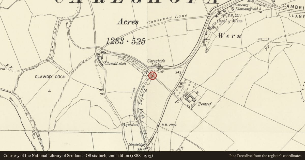
Slide toward Today to fade the historical sheet and see the modern map underneath.
David Rumsey Map Collection, Stanford LibrariesDavid Rumsey Map Collection, Stanford LibrariesDavid Rumsey Map Collection, Stanford LibrariesDavid Rumsey Map Collection, Stanford LibrariesLlyfrgell Genedlaethol Cymru – The National Library of Wales
5 historical maps cover this location, the earliest the 1795 map "To Sir Watkin Williams-Wynn Bart ... the map of the six counties of North Wales is most humbly inscribed by his obedient humble servant" (Llyfrgell Genedlaethol Cymru – The National Library of Wales).
Historical maps covering this location
- 1795 · To Sir Watkin Williams-Wynn Bart ... the map of the six counties of North Wales is most… (Llyfrgell Genedlaethol Cymru – The National Library of Wales)
- 1883 · Watershed map England, Wales 3. (David Rumsey Map Collection, Stanford Libraries)
- 1897 · 137 Oswestry (Hills) (David Rumsey Map Collection, Stanford Libraries)
- 1901 · Sheet 9 and 10. (David Rumsey Map Collection, Stanford Libraries)
- 1916 · Sheet 60. Shrewsbury. (David Rumsey Map Collection, Stanford Libraries)
Cadw's description
Location
On south bank of Montgomeryshire Canal, abutting bridge No 95.
History
Built about 1819 when the first lock-keeper was appointed, extended and improved later in C19.
Exterior
Original two-storey rubble cottage facing west with gable end to canal. Pitched slate roof, tall brick stack inserted to left. Two-window front with casements under (later) arched brick heads, offset gabled and trellised porch to right with finial.
Parallel brick and slate range to rear, similar casements; low cross-range with gable incorporated into bridge parapet to E. Brick outhouse in garden.
Reason for designation
Group value with other canal structures in exceptional location at Carreghofa Locks.
Nearby in the register
- Lower Lock ChamberTransportunder 1 mi
- Bridge 95 over the Montgomeryshire Canal adjoining No 1 The LocksTransportunder 1 mi
- Lock Gates and Paddle GearTransportunder 1 mi
- Lock Gates and Paddle GearTransportunder 1 mi
Other entries of the same register within about three miles of this one, by straight line.