Cof Cymru: National Historic Assets of Wales · Wales
Aberavon Bridge (partly in Aberavon community)
Port Talbot, Neath Port Talbot, Wales
A Grade II listed building in Port Talbot, Neath Port Talbot, designated on 29 August 1979.
The record
- Designation
- Listed building, Grade II
- Broad class
- Transport
- Date of designation
- 29 August 1979
- Locality
- Port Talbot
- Town
- Port Talbot
- Community
- Port Talbot
- Unitary authority
- Neath Port Talbot
- Country
- Wales
- Coordinates
- 51.59655, -3.78371
- Cadw reference
- 14173
Slide toward Today to fade the historical sheet and see the modern map underneath.
David Rumsey Map Collection, Stanford LibrariesDavid Rumsey Map Collection, Stanford LibrariesDavid Rumsey Map Collection, Stanford LibrariesDavid Rumsey Map Collection, Stanford LibrariesDavid Rumsey Map Collection, Stanford Libraries
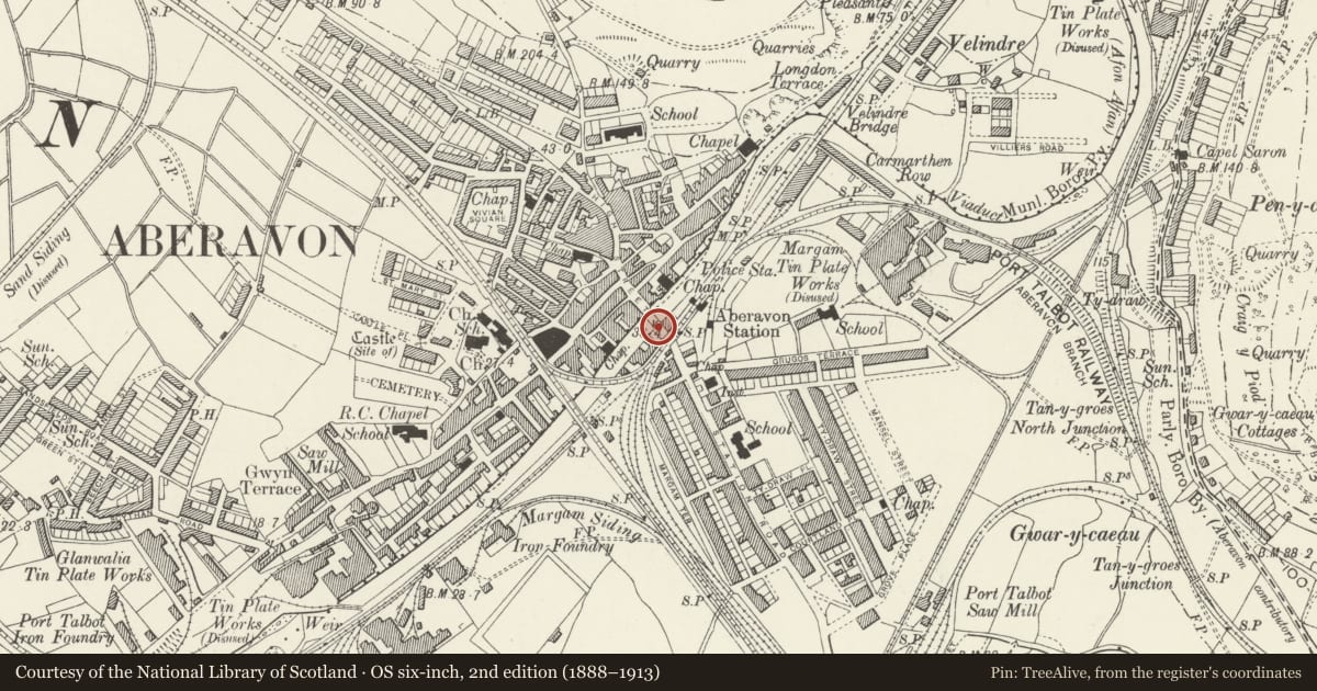
5 historical maps cover this location, the earliest the 1636 map "Cornubia : Devonia, Somersetus, Dorcestria, Wiltonia, Glocestria ..." (David Rumsey Map Collection, Stanford Libraries).
Historical maps covering this location
- 1636 · Cornubia : Devonia, Somersetus, Dorcestria, Wiltonia, Glocestria ... (David Rumsey Map Collection, Stanford Libraries)
- 1637 · The fourth table of England. Cornub. Devonia, Somerset etc. (David Rumsey Map Collection, Stanford Libraries)
- 1865 · England and Wales. England No. 6. (David Rumsey Map Collection, Stanford Libraries)
- 1891 · Sheet 10. Ordnance Survey of England and Wales. . (David Rumsey Map Collection, Stanford Libraries)
- 1897 · 247 Swansea (Hills) (David Rumsey Map Collection, Stanford Libraries)
Cadw's description
Location
The bridge crosses the River Afan and serves as the physical link between the shopping centres of Aberavon and Port Talbot, the former a development of the 1990s. The roadway is now pedestrianised.
History
Built in 1842 to the design of William Kirkhouse, engineer of the Tennant Canal and author of an unexecuted plan to extend the canal to Aberavon. Later widened by half, probably in 1893 (lower date on keystone). The bridge formerly carried the A48 trunk road.
Exterior
Bridge of 3 low segmental arches with flat deck. Spandrels and parapets faced with coursed stone; voussoirs, pilasters and cutwaters of tooled dressed stone. The voussoirs are of pecked stone, the raised keystones with herring bone decoration. The central keystone on the S side bears the dates '1842' and '1893'. The pilasters rise from the triangular cutwaters to the tops of the parapets. String course to parapets which have flat stone coping. Straight abutments, mainly rebuilt.
Reason for designation
Listed as a C19 bridge of fine architectural quality.
Nearby in the register
- Aberavon Bridge (partly in Port Talbot community)Transportunder 1 mi
- Ebenezer ChapelReligious, Ritual and Funeraryunder 1 mi
- Forecourt Walls, Railings and Gates to Ebenezer ChapelReligious, Ritual and Funeraryunder 1 mi
- Bethany ChapelReligious, Ritual and Funeraryunder 1 mi
Other entries of the same register within about three miles of this one, by straight line.