Cof Cymru: National Historic Assets of Wales · Wales
Gateway and Quadrant Walls Leading to Twyn yr Hydd
Margam, Neath Port Talbot, Wales
A Grade II listed building in Twyn yr Hydd, Port Talbot, Margam, Neath Port Talbot, designated on 24 February 1975.
The record
- Designation
- Listed building, Grade II
- Broad class
- Domestic
- Date of designation
- 24 February 1975
- Locality
- Twyn yr Hydd
- Town
- Port Talbot
- Community
- Margam
- Unitary authority
- Neath Port Talbot
- Country
- Wales
- Coordinates
- 51.55219, -3.71711
- Cadw reference
- 14169
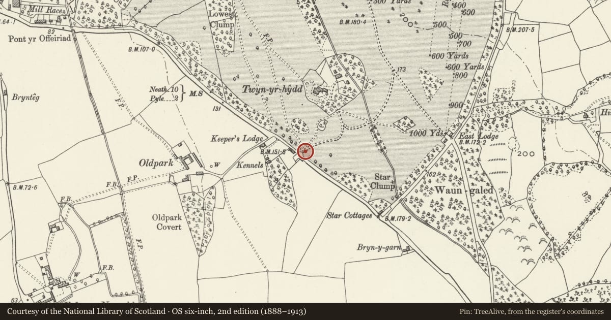
Slide toward Today to fade the historical sheet and see the modern map underneath.
David Rumsey Map Collection, Stanford LibrariesDavid Rumsey Map Collection, Stanford LibrariesDavid Rumsey Map Collection, Stanford LibrariesDavid Rumsey Map Collection, Stanford LibrariesNational Library of Scotland
5 historical maps cover this location, the earliest the 1636 map "Cornubia : Devonia, Somersetus, Dorcestria, Wiltonia, Glocestria ..." (David Rumsey Map Collection, Stanford Libraries).
Historical maps covering this location
- 1636 · Cornubia : Devonia, Somersetus, Dorcestria, Wiltonia, Glocestria ... (David Rumsey Map Collection, Stanford Libraries)
- 1637 · The fourth table of England. Cornub. Devonia, Somerset etc. (David Rumsey Map Collection, Stanford Libraries)
- 1865 · England and Wales. England No. 6. (David Rumsey Map Collection, Stanford Libraries)
- 1907 · 248 Pontypridd (Hills) (David Rumsey Map Collection, Stanford Libraries)
- 1930 · OS Popular Edition 1919-1947 (National Library of Scotland)
Cadw's description
Location
Inserted into the boundary wall of Margam Park which runs along the N side of the A48. Twyn yr Hydd can be seen to the rear.
History
The road entrance to Twyn yr Hydd and probably contemporary, c1893.
Exterior
Rusticated ashlar gate piers with moulded cap stones surmounted by ball finials on pedestals. On plinths with moulded top edge; jambs to internal sides. Double cast iron gates: The top rails sweep down with scroll work below and raised scrolls in the centre and towards the ends. Uprights with pointed finials. Lock bar with additional uprights, which rise to form scrolls. Low dog rails with chevroned finials. Adjoining the piers are curved quadrant wings of snecked rock-faced stone with saddleback coping. Square end piers with flat capstones, moulded to the undersides. The park boundary wall continues from here, random rubble with rough saddleback coping.
Reason for designation
Listed for its architectural detail and character, a prominent entrance on the A48. Group value with buildings and structures at Twyn yr Hydd.
Nearby in the register
- Entrance to Twyn yr Hydd and Flanking WallsGardens, Parks and Urban Spacesunder 1 mi
- Garden Wall at Twyn yr HyddGardens, Parks and Urban Spacesunder 1 mi
- Twyn yr HyddDomesticunder 1 mi
- Kitchen Garden Wall and Glass House at Twyn yr HyddGardens, Parks and Urban Spacesunder 1 mi
Other entries of the same register within about three miles of this one, by straight line.